About Me

My photo
Hello! My name is Keith Gault and I've been tramping the hills of the UK and further afield for over 40 years now. This blog records some recent hill days undertaken either on my own, with friends, or with clients under my guided hillwalking Company: Hillways (www.hillways.co.uk). I hope you enjoy my diary; please feel free to comment on any of the walks. I will respond to any direct questions.

Wednesday, 24 March 2010

Cairngorms

Lairig Ghru

It has been wild and wintery on the Cairngorms plateau this week but a walk through Rothiemurchus forest gave some softer images as winter slowly gives way to spring:

Braeriach

Lochan Deo

Meall a'Bhuachaille

Check out my future plans for similar walks on: http://www.hillways.co.uk/summer/summer.htm

Tuesday, 16 March 2010

Ben Lomond

Ben Lomond

The opportunity to complete a 3rd ascent of Scotland’s most southerly Munro presented itself this week and was readily grasped given some good weather, clear tops and the lingering challenge of winter conditions on high. This is a straightforward, uncomplicated Munro with a well-engineered path that climbs steadily through some de-forested woodland and over a broad grassy shoulder before zigzagging up a short sharp ramp. This puts you on the impressive summit ridge that arcs around a precipitous north-eastern corrie.

Up Loch Lomond to the Arrochar Alps

The car park at Rowardennan was surprisingly busy for a midweek morning in March and bets were soon laid on the chances of a family of 3 clad in trainers and shorts setting foot on the summit! Following the deforestation of the lower slopes, the mountain is visible for much of the early stages and 20 mins normally sees you out of the remaining trees and on to the open hillside. A great view of Loch Lomond opens out to the south and further afield, the Ochils, Central Belt and even the Pentland Hills can be seen on clear days!

Delicate Footwork on the Summit Ridge

As expected, snow and ice were still very much in evidence on the summit ridge and care was again needed to negotiate the summit ridge up to the solitary trig point. Given several days of higher temperatures and the southerly aspect of the mountain’s main route of ascent, the snow was generally soft enough to take a boot and wherever ice was encountered, it could be by-passed without having to revert to ice axe or crampons.

The Summit

The view north encompassed the familiar Arrochar Alps, the Crianlarich hills and a distant Ben Lawers away to the north-east. A young woman on the summit clad in full winter gear announced she was making good use of a month off work by working her way up the western Highlands. And with that, she cheerfully picked up her ice axe and headed off for Torridon!

The View South Across Loch Lomond

The descent was swift and many groups were passed, still heading up this popular and accessible peak which probably has more repeat ascents (amongst Glaswegians, in particular) than most other Munros. Unsurprisingly, there was no sign of the family in trainers!

On the way home, I couldn’t resist the temptation of having my photograph taken at the beginning of the West Highland Way. Not a walk that particularly appeals to this stravaiger of the Scottish mountains, but it was fun to pretend for a few minutes and to be wished good luck by a few good folk of Milngavie!

The Imposter!

Check out my future plans for similar walks on: http://www.hillways.co.uk/summer/summer.htm


Saturday, 13 March 2010

Ben Vane - Again!

Ben Vane

Yet another visit to the Arrochar Alps this weekend and a return to that straightforward and uncomplicated wee Munro - Ben Vane. Hah!

The southern highland glens are all free of snow now. Up top, the snow is largely confined to the upper half of the higher peaks. When you do encounter the snow, it is generally soft and patchy. But as you climb higher....

Rainbow on Ben Vorlich

The ascent route was the normal one from Inveruglas viewpoint and up Coire Grogain(see Feb 10 entry). A cold NW wind took the edge off the warmish sunshine and the summits of the surrounding peaks were generally clear. A large number of assorted groups of walkers heralded the approach of Spring and improving weather. The steep 600m flog up the SE face of Ben Vane was as unrelenting as always but widening views across to Ben Vorlich and the other Arrochar Alps provided welcome distraction from the toiling. Best of all though, the shapely white cone of Ben Lomond stood out clearly to the SE looking mightily impressive in its winter raiment.

Ben Lomond

Once on the summit ridge of Ben Vane things changed markedly and rapidly. The snow suddenly hardened to an icy crust, a strong bitter wind made walking difficult and the air temperature dropped significantly! The remaining 300m distance to the summit cairn proved to be a real struggle. Ice axe replaced trekking poles (got very close to donning crampons), mittens replaced gloves and everything suddenly became a real challenge. Fortunately, after struggling up one particular icy step, the cairn finally hove into view and a brief sense of achievement interrupted the hard concentration. In such conditions, a brief pause on the summit was all that was required and an about turn was followed by another 20 mins of ‘careful does it’ before easier conditions were encountered and a straightforward descent accomplished back down the mountain.

On the Icy Summit Ridge

This was a singular lesson in Scottish winter hillwalking. Apparently benign conditions in the glen belying a different world of winter hazards on the summits all waiting to ensnare the unprepared or unequipped walker. Take care folks and always carry ice axe and crampons between November and April – or be prepared to turn back as soon as your boots strikes ice!

Check out my future plans for similar walks on: http://www.hillways.co.uk/summer/summer.htm

Saturday, 6 March 2010

Springtime in the Pentlands

Glencorse Reservoir

After almost 3 months of snow, the sun has finally come out and struggled high enough into the sky to give a little warmth! Suddenly, everyone’s talking about Spring and buds and bulbs everywhere are beginning to poke nervous green shoots out of the thawing ground. The Pentland Hills near Edinburgh have had their fair share of snow this winter and have at times been plastered completely in deep powder. During the last few days though, the snow has finally started to recede and the combination of sun, snow and increasing daylight suggested a wander into these unpretentious uplands would give a handsome reward.

Walking in from the Flotterstone Inn and up the metalled road past Glencorse Reservoir, everything was bathed in warm sunshine and people, dogs and children were everywhere. The reservoir was still partly frozen though and a lingering chill in the air provided a necessary reminder that Spring still had some way to go before it would need to start paying council tax! This road walk was very much the preferred option today as the hill routes would have proved to be a messy and tiring struggle in soft snow and saturated ground. However, given the settled weather forecast for the next week or so, this is likely to be a temporary state of affairs and a return to the higher routes will not be far off now.

East Kip and Loganlea Reservoir

A friendly fisherman stopped to bemoan the paucity of gullible rainbow trout in the reservoir and he trundled off seeking a more rewarding spot from which to cast his line. A typically scatty collection of Pentland sheep got themselves into a manic state of distress and quite unnecessarily launched themselves across the icy waters of the Logan Burn in order to escape a non-existent threat from innocent walkers. Having reached Loganlea Reservoir, the upper reservoir in the glen, a growing appetite for a late lunch suggested an about turn and the road was followed back down to the Flotterstone Inn car park. Again, the winning combination of sun and snow – now both beginning to lose their influence on the scene – provided a stunning backdrop to the late afternoon landscape.

These soft, rolling hills were beautiful today and there convenience, being so close to Edinburgh, and what they have to offer, should not be underestimated. But now it’s time to return to the high mountains and some not too distant Munros are calling.......

Castlelaw Hill and Glencorse Reservoir

Check out my future plans for similar walks on: http://www.hillways.co.uk/summer/summer.htm

Saturday, 6 February 2010

Arrochar Alps III - Ben Vane

Ben Vane From Coire Grogain

It’s been a grey old day in the SW Highlands and a cold Caledonian wind has chilled me to the bone. I’ve been back again to the Arrochar Alps to climb Ben Vane, the second lowest Munro and the last of the Arrochar hills I am visiting third time around. It’s a good wee hill for a summer’s evening or a brief February day. I was stuck with the latter! The mountain is best accessed from the Inveruglas viewpoint half way up Loch Lomond (see the Ben Vorlich blog entry from November). Once again, the Hydro road up Coire Grogain leads you to the foot of Ben Vane quite comfortably and the day’s work – a fairly unrelenting steep 600m slope – presents itself in front of you after only about 45 mins from the car.


The Summit Cairn With a Distant Ben Lomond

Unlike some recent outings, there were quite a few walkers about; like me, wrapped up in windproofs in order to keep out that pesky wind! A well-marked path guides you up the steepness, a steady pace ensuring you soon gain height and win the impressive view back down the glen towards Loch Lomond and the hills to the east. Not today I hasten to add – cloud appears to have become my new hill buddy! Grassy slopes give way to more rocky terrain and after a few twists and turns around some rock outcrops, and a number of unhelpful false summits, you arrive suddenly at the top of the slope only 300m from the summit cairn of Ben Vane (915m; middle hill). Today’s climb passed quickly as the persistent cloud prevented any panoramic views from distracting me. The only time I really stopped was at the summit where a friendly group of club walkers from Glasgow proved good company for a while.

Then it was back the way I had come and I didn’t waste much time beating down that Hydro road to the comfort of the car and the warm embrace of it’s very efficient heater!

Ben Vane and Ben Vorlich From Ben Lomond


Check out my future plans for this winter on: http://www.hillways.co.uk/winter/winter.htm


Wednesday, 3 February 2010

The Jaws of Drumochter


All this snow and an unexpected opportunity to get out for a solo romp over some Munros conspired to have me driving up a strangely traffic-free A9 at a dark early hour. My target for the day was the group of 4 hills which lie immediately to the west of the Pass of Drumochter (462m) overlooking the A9. On earlier visits, I had climbed these hills over 2 separate days but I was determined that all 4 would go in this single short winter’s day. Given the high start, easy-going on frozen ground and the close proximity of the A9, I knew it could be done.

The Drumochter hills hardly rate amongst Scotland’s greatest but there’s really no such thing as a bad Scottish hill! Sgairneach Mhor is a typically rounded Grampian lump with 3 well-defined spurs extending from the summit plateau. It’s most impressive feature is a cliff-girdled corrie cradled in its northern slopes: Coire Creagach. Beinn Udlamain, the highest of the group is simply a long ridge oriented NE to S with a line of old rusting fence posts extending along its entire length. A’ Mharconaich would be undistinguished but for its NE corrie which gives a graceful yet dramatic appearance driving south along the A9 . Regrettably, Geal-charn (one of 6 Munros so named) has no redeeming corrie to offset its rather plain appearance. Nevertheless, all are fine walking hills and on this bitterly cold yet clear February day, they were well placed to provide a memorable day far from the madding crowd.

The View South From Sgairneach Mhor Towards Schiehallion

I parked and crossed the railway and headed west up the stalkers’ track into Coire Dhomhain. Few others were going to share my footsteps and I didn‘t speak to a soul all day. After 2 km of undulating walking over the moraine heaps in the lower glen, I struck left up the open flanks of snow heading for the north east ridge of the hill. The climb does not take long but just as I reached the skyline, cloud descended over the plateau and I was enveloped in a white world of cloud, snow and a chilly wind. Soon after, the summit cairn loomed out of the mist and I reached the summit of Sgairneach Mhor (991m; big scree) some 90 minutes after leaving the A9.

Far From The Madding Crowd

Although the traverse around and across the head of Coire Dhomhain towards Beinn Udlamain is straightforward in clear conditions, today would require care and precise navigation to ensure staying on course. Right on schedule the corrie appeared and the small lochan I was using to locate the line for Beinn Udlamain lay directly ahead! Mist obscured the skyline 200m above me and consequently, the impending climb appeared much more daunting than I knew it to be. So it was that after quite short a climb, the slope eased and the appearance of a line of broken and rusted fence posts led me to the summit cairn of Beinn Udlamain (1011m; jointed, or unsteady hill). All I needed to do now was follow the fence posts north and easy slopes would take me eventually to my 3rd Munro of the day: A’ Mharconaich.

The Ridge North From Beinn Udlamain Towards A’ Mharconaich

Out came the sun, away went the map and compass, and on I went over the frozen stones and snow along the wide crest of the ridge. In the gathering gloom I pressed on - and on - until the second of 2 cairns appeared out of the mist and I stood once again on A’ Mharconaich (975m; place of horses) with a great view suddenly revealed north to Speyside over the mountain’s dramatic NE corrie. Time and daylight were now pressing and I hurried back to where the path on to Geal-charn descends to the intervening bealach above Coire Fhar. Fresh footsteps in the snow helped confirm the line to take and the bealach duly appeared with my last hill of the day looming towards me with its summit just in the clouds. Geal-charn (917m; white hill) is the 6th lowest Munro but its ascent was the 4th of the day a rewarding achievement on a short winter’s day! Fortunately, the line of this mountain is quite straightforward and the going was again easy on hard ground. I descended directly towards Balsporran cottages, strangely dark and quiet although I knew them to be inhabited, as the main road and traffic noise edged closer and closer. Eventually I re-crossed the railway and immediately afterwards came upon the cottages. The lights were indeed out but there were plenty of signs of occupation which was good to see - the highlands have too many ruins.

I left the darkened cottages behind and found the cycle-way which I knew ran parallel to the A9 hereabouts. Walking south, somewhat closer to the road than I had hoped, the glare from the on-coming car headlights kept blinding me and I frequently had to pause until they passed. But slowly, oh so slowly, the dark outline of the Boar of Badenoch slipped by in the darkness and the Jaws of Drumochter gathered me in and pointed the way home.


Check out my future plans for this winter on: http://www.hillways.co.uk/winter/winter.htm


Saturday, 24 October 2009

Assynt & Coigach - The NW Highlands

Stac Pollaidh

‘Gloves’ Douglas was in town and was looking for some action. He had Weegie Girl tagging along with him. If there were hills to be climbed, she wanted in! So I found some hills for them and off we went to the far north-west of Scotland, to the ancient lands of Assynt and Coigach. The hills here are perfect two-thirds replicas of the mighty Torridon mountains further south and offer great hillwalking for less effort than your typical Munro. ‘Gloves’ arrived with his truckload of Red Bull determined to get up as many hills as possible and Weegie’s new boots looked like she meant business! Mind you, she normally does!

Ben More Coigach

Day One called for an easy walk-in, good views and not too much distance – Ben More Coigach fitted the bill admirably. This complex hill presents a solid wall of Torridonian sandstone to those driving north up the Ullapool road. In reality, this wall is but one side of a reclining horseshoe and the mountain actually comprises several distinctive tops, foremost of which is Sgurr an Fhidhleir (705m; peak of the fiddler) which sticks out a blunt uncompromising nose across the loch-strewn landscape to the north. We parked at Blughasary and walked up a good track for 3 km before cutting across country to climb Ben More Coigach’s eastern top, Speicein Coinnich (717m). This entailed an interesting but successful river crossing which everyone achieved without mishap! Once on top the long ridge stretched out towards the sea and the Summer Isles glistened in the autumnal sunshine. The actual summit of Ben More Coigach (743m; big hill of Coigach) lies just north of the main ridge. The going is very easy and the traverse of the main ridge is full of interest. As you work your way down to the south-western top of Garbh Choireachan (733m), the ridge becomes a narrow scramble over sandstone pinnacles all of which can be by-passed on a good path on the northern side.

Approaching Garbh Choireachan

We returned the same way enjoying great views all-round, but particularly to the north where all of the following week’s hills could be seen stretching away towards the top of Scotland. This was Gloves’ first outing with trekking poles and it was only late in the day that we became aware of how like Brad Pitt they made him look. Brad Pitt playing Benjamin Button that is! Once he was shown how to extend them beyond the 3 feet length he had seemed happy with, all was well and he was able to walk quite upright! That said, his slow motion back-flip into a peat bog was executed with great aplomb! Some people are just so ostentatious and attention-seeking on the hill don’t you think?

Stac Pollaidh's Crumbling Summit Crest

The next day saw us tackling Scotland’s finest wee hill – Stac Pollaidh (612m; steep rock at the pool). This diminutive, but spectacularly attractive prominence is a crumbling ridge of sandstone surrounded by steep heather-covered scree slopes that give it a somewhat volcanic – and extremely photogenic - appearance from the east. Stac Pollaidh stands only a kilometre north of the twisting single-track road to Achiltibuie above Loch Lurgainn. An excellent path climbs and curves around the eastern side of the mountain and on to a saddle on the summit crest. Once on top, it’s just (did I say just?) a scramble along the ridge over, along and around a series of sandstone pinnacles until a final ‘difficult step’ suddenly throws down a challenge to those uncomfortable with slipping, falling and death! The small tower that now blocks the way looks worse than it is but caution is definitely advised even though the actual summit of the mountain now lies only a few metres beyond. Today, a ferocious wind persuaded us that retreat was the better part of discretion and we retired back along the ridge in no way feeling short-changed such was the entertainment value (and challenge) of the rest of the ridge.

'Gloves' Ponders the Difficult Step With A Secret Admirer!

Rather than return by the upward path, we picked up a continuation of the path that circles the whole hill thus allowing close scrutiny of the entire summit ridge from below. Stac Pollaidh offers a short day and is an ideal ‘stocking filler’ in between the bigger mountains in the area. It is always interesting and never palls no matter how many times you scramble along that crumbling pile of sandstone. Be quick though; devoid of its protective quartzite cap, the mountain’s sandstone is eroding rapidly and the elements are busy remodelling the pinnacles - they wont be there for ever!

Cul Mor

Our third hill day took us to the highest peak in Coigach, Cul Mor (849m; big back). From a lay-by below Knockan Crag 3km south of Elphin, a good stalkers path leads across country before climbing gradually up gently sloping quartzite strata to the subsidiary top of Meallan Diomhain. Here, the underlying rock changes to the familiar Torridonian sandstone and the summit cone of Cul Mor rises up directly in front of you. This can be tackled head on up steep mixed ground or, more usually, by crossing a small plateau and ascending Cul Mor’s north-eastern ridge. This provides not only a welcome path, but also good views across to Suilven – the pride of Assynt – and the impressive Coire Gorm (blue corrie) whose cavernous recesses drop vertically from the summit of the mountain. Take care approaching the summit as you once again encounter the quartzite in the form of tricky-sized boulders which demand care, particularly when wet. Once on top, however, no further difficulties should be encountered.

A Weak Attempt at Hiding on the Summit of Cul Mor!

When climbing Cul Mor, do make the effort to walk the near-level kilometre along the mountain’s north-western ridge, Sron Garbh (rough nose), to a spectacular viewpoint over the Inverpolly National Nature Reserve. This vast empty area of ‘lochan and knockan’ landscape sits on underlying Lewisian Gneiss, some of the oldest rocks in the world at 1500-2500 million years of age, which surprisingly predates even the X-Factor! Those envisaging an exploration of this remote and watery land would be well advised to consider asking Santa to bring them a canoe for Christmas! The return to the car reverses your route back along Sron Garbh to a gravelly bealach between Cul Mor and its twin top Creag nan Calman (828m; crag of the dove). This can be climbed for completeness before descending eastwards back over Meallan Diomhain to the stalkers path.

Quinag on a Sunnier Day

Day 4 took us to the northern edge of Assynt and the wonderful 3-Corbett triptych that make up Quinag (milk pail). The complex Y-shaped collection of peaks and ridges looks particularly impressive when approaching from the north over the graceful curve of the Kylesku Bridge. However, the mountain is most accessible from an old quarry car park just below the summit of the watershed between Loch Assynt and Kylesku. This gives a relatively high start and a good stalkers path (currently undergoing well needed repairs) to follow initially before cutting across to pick up the easier slopes of the mountain’s southernmost peak and first Corbett, Spidean Coinich (764m; peak of the moss). This entertaining climb ascends over gently sloping strata of quartzite before dipping slightly followed by a final steep climb up to the summit. Today, this became a real battle against a remorseless buffeting wind and it was a real struggle to fight our way to the summit cairn which is perched right on the edge of the peak’s northern face. We were getting quite angry with the wind now so wasted no time in moving on in search of some shelter. As expected, once below the summit cone we entered a zone of calm which enabled us to stand upright and engage in conversation again, let alone walk properly! Regrettably, the thick cloud precluded our full enjoyment of the usually entertaining central spine of Quinag and we didn’t see anything until well down the mountain. A comfort break whilst ‘Gloves’ went off in search of a fully-flushing WC (or so it seemed given the time he took) ensured Weegie and I cold-soaked for just a bit too long. The resultant warm-up exercises in the form of a stylish hip-swerving dance thing (with impressive use of trekking poles for visual effect) was gleefully captured on video by ‘Gloves’. He will publish it on Facebook at his own peril.....!

!
Not For General Release!
The continuing dreich failed to convince us that the complete traverse of Quinag’s ridges and 2 other Corbetts would be worth the misery so we turned off at the Bealach a’Chornaidh and followed the stalkers’ path back to the car. Quinag is a great mini-massif, full of entertainment and interest. It is worth keeping for a good day, or at least a day of clear tops so the intricacies of the mountain can be enjoyed and appreciated to the full. It also comes complete with a fully-flushing loo – allegedly!

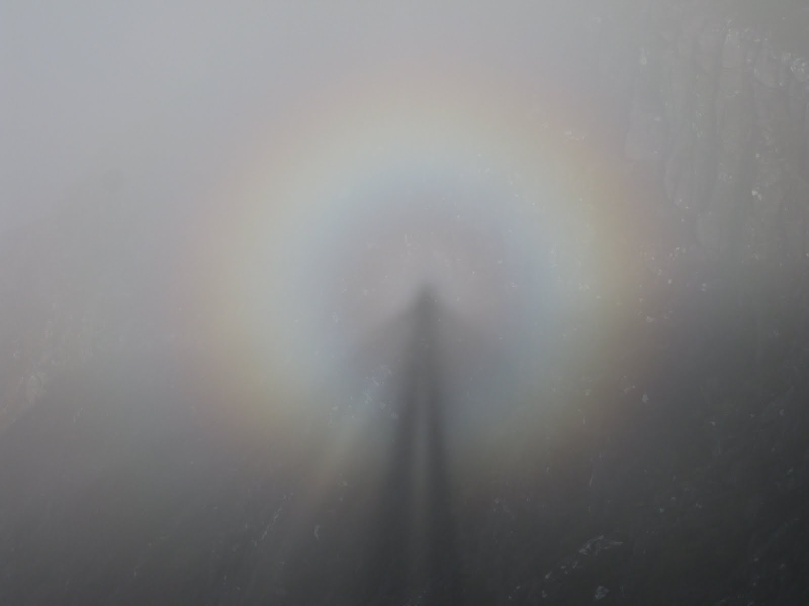
Brocken Spectre

For our last day, we decided to climb Cul Beag (769m; little back). This hill provides a good half-day with a short walk-in and modest climb whilst giving great views over the Coigach peaks. A larger than usual passing place 3km along the Achiltibuie road from Drumrunie provides a useful start for a fairly damp pathless trudge up a soggy corrie to the 500m level. Here, the going gets easier over a sandstone pavement until the upper mountain appears and a steep climb takes you up the final slopes to the summit. Swirling cloud and bright sunshine conspired to give us a great view of our brocken spectres – rainbow-coloured halos which encircle your own shadow and which are a familiar sight in such conditions. ‘Gloves’ was much impressed!

This was a great week with great companions who were a real pleasure to walk with. Check out my future plans for similar walks on: http://www.hillways.co.uk/summer/summer.htm