About Me

My photo
Hello! My name is Keith Gault and I've been tramping the hills of the UK and further afield for over 40 years now. This blog records some recent hill days undertaken either on my own, with friends, or with clients under my guided hillwalking Company: Hillways (www.hillways.co.uk). I hope you enjoy my diary; please feel free to comment on any of the walks. I will respond to any direct questions.

Wednesday, 6 March 2013

The Cairngorms in Winter – I


Coire an t-Sneachda

The new season has started with a welcome return to the Cairngorms with Natsuyo from Japan and Andy from a little closer!  Sustained low temperatures and generally settled weather have consolidated the snowpack and maintained a reasonable amount of snow for early March.  We weren’t out to break any records; it was just a gentle introduction to winter mountaineering for Natsuyo and an opportunity for Andy to get the old boots out and get back to the hills!

Day 1


The Kincardine Hills

By way of easing gently into things, we opted for a traverse of the Kincardine Hills – that shapely heathery ridge above Glenmore that always come in useful as an alternative to the high tops in poor weather.  We started from Glenmore, wandered leisurely through the forest past An Lochan Uaine (the little green lochan) and up to Ryvoan bothy.  The new(ish) path up the hill from the bothy makes for a very straightforward climb and it’s less than an hour to the large stone cairn atop Meall a’Bhuachaille (810m; hill of the shepherd).


Meall a’Bhuachaille

It was cool and breezy on top and the atmosphere was fairly hazy – and not from heat either!  So no great views today.  We continued our traverse over Creagan Gorm (732m), the unnamed double top (711m) and finally, Craiggowrie (687m).  Natsuyo’s camera battery ran out of power half way through the day – no laughing matter if you’re Japanese, I can tell you!  In the event, it wasn’t a great day for photos or hill-top picnics and we didn’t linger long anywhere.  There were very few other souls about and we were soon heading down through the pine trees towards Milton Cottage and the waiting car on the Coylumbridge road.  We would try something harder tomorrow…


Meall a’Bhuachaille & Creagan Gorm

Day 2

We awoke to clear skies and bright sunshine so headed up the ski road to the Day Lodge & Funicular car park at 630m.  Quite a few dedicated skiers were enduring the challenge that is Scottish skiing and winter skills groups seemed to be everywhere, heading off to practise their belays and ice axe skills and maybe building the odd snow shelter. 


Coire Cas

We kept to the access track initially but left it soon after passing under the funicular and struck up across the open hillside on the western flank of Coire Cas.  Very low temperatures had produced an icy snowpack so we donned crampons almost immediately and they didn’t come off until nearly back at the car!


Approaching Spot Height 1141 (Natsuyo loving the crampons...)!

We moved up the well-defined ridge of Fiacaill a’ Choire Chais to its termination at Spot Height 1141 – a top very reminiscent of the Silberhorn above Interlaken in the Bernese Oberland.  Arriving here opened up impressive views across Coire an t-Sneachda and the Cairngorm plateau.  Cairn Gorm itself lay conveniently close.


Orographic Cloud Over the Cairngorm Plateau

Natsuyo was moving effortlessly in her crampons (my words, not hers!) and we quickly traversed across and then up to the ice-caked automatic weather station and summit cairn of the UK’s 6th highest mountain, Cairn Gorm (1245m; blue mountain).  Unsurprisingly, there were more people up here enjoying the intermittent views as thin cloud washed across the summit taking the sun away for the first time that day.


Approaching Cairn Gorm Summit

We descended almost reluctantly, but quickly, past the colourful crowds thronging around the Ptarmigan restaurant area.  We took the well-constructed path that leads down between the ski runs and along Sròn an Aonaich and back to the car park.  A most agreeable day.


Cairn Gorm & Coire Cas

Day 3


The Fiacaill Buttress

Our last day saw the same cool and clear conditions prevailing, but with no blue sky or sun to enhance the occasion.  We returned to the ski car park and traversed around and up into Coire an t-Sneachda.  Again, the slopes were covered in numerous winter mountaineering groups up from Glenmore Lodge, and other places no doubt, and the occasional ski tourer.  We heard, and then saw, some ptarmigan and I managed to get reasonably close for a clear photo of their winter plumage.


Mr & Mrs Ptarmigan in Winter Plumage

On reaching the heart of the coire, we spent some time admiring the surrounding ice-girt cliffs and a couple of intrepid ice climbing parties before climbing out to the east and returning once again to Spot Height 1141.  From what was now quite a cool and breezy summit, we reversed the previous day’s climb and descended through the ski runs and back to the car park.


 The Cliffs of Stob Coire an t-Sneachda

All in all, this was a most enjoyable start to the season and it was good to be back in the hills with nice people doing what I do.  I’ll be returning to the Cairngorms next weekend for some winter skills and, as fresh snow is falling up there as I write, I can’t wait! 

   
Check out my plans for the coming season at: http://www.hillways.co.uk/summer/summer.htm


Thursday, 28 February 2013

A Spring Day in the Pentland Hills


West Kip From Red Gate

By way of a warm-up for next week’s season-opening trip to the Cairngorms, I  thought I’d take advantage of the arrival of Spring and wander up into the Pentlands for some sun.


Threipmuir Reservoir

Parking at Threipmuir, I headed up the private road past the Red Moss & Bavelaw Marsh nature reserves.  Despite the late morning sun, the low overnight temperatures of the past week were clearly evident in the frozen surface of Threipmuir Reservoir as I crossed Redford Bridge.   So no waterfowl to see today but I headed up the Bavelaw beech avenue to the welcome sound of an unseen woodpecker!


Black Hill From the Red Road

I left the woods for open country and followed the Red Road (named after the underlying red sandstone) which leads across the Pentlands to Nine Mile Burn.  Just under 2Km of gentle climbing brought me to the Red Gate and the familiar and welcome view of the main Pentland spine from West & East Kip to Scald Law and on to Carnethy Hill.

 
Carnethy Hill From Hare Hill

By way of a change from my usual traverse of these hills, I turned left at the Red Gate and walked up to the multi-cairned top of Hare Hill (449m).  For the first time since October, I was able to sit on a hill top and soak up the warmth of the sun –  a particularly pleasurable thing to be able to do in February!


East & West Kip From Hare Hill

Descending along the NW ridge of Hare Hill, I came to a poignant memorial to the crew of a German Junkers JU 88 aircraft which crashed here on the night of the 25th March 1943 with the loss of all 4 crew members.  The crew were buried in Kirknewton graveyard and relatives of the aircraft’s captain attended a plaque unveiling ceremony at the crash site in 1999.


The Hare Hill War Memorial

From here, I descended to intercept the Red Road before retracing my steps along the Beech Avenue back to Threipmuir.  A very pleasant day - and now I’m definitely ready for the winter snow of the high Cairngorms!


Bavelaw Beech Avenue

Check out my plans for similar walks at: http://www.hillways.co.uk/summer/summer.htm

Sunday, 28 October 2012

Lochaber 2012


Ben Nevis & Carn Mor Dearg

The last trip of the year (definitely; maybe) saw some great autumnal weather (with the exception of one snow blizzard!) and some quality hillwalking.  We also found time for some challenging winter navigation practise!  Based in Fort William, Leanne, Fiona and myself ventured forth each day to all 4 points of the compass attaining 7 Munro summits and covering over 50km of assorted tarmac road, estate tracks, hill paths and quality mountain bog!

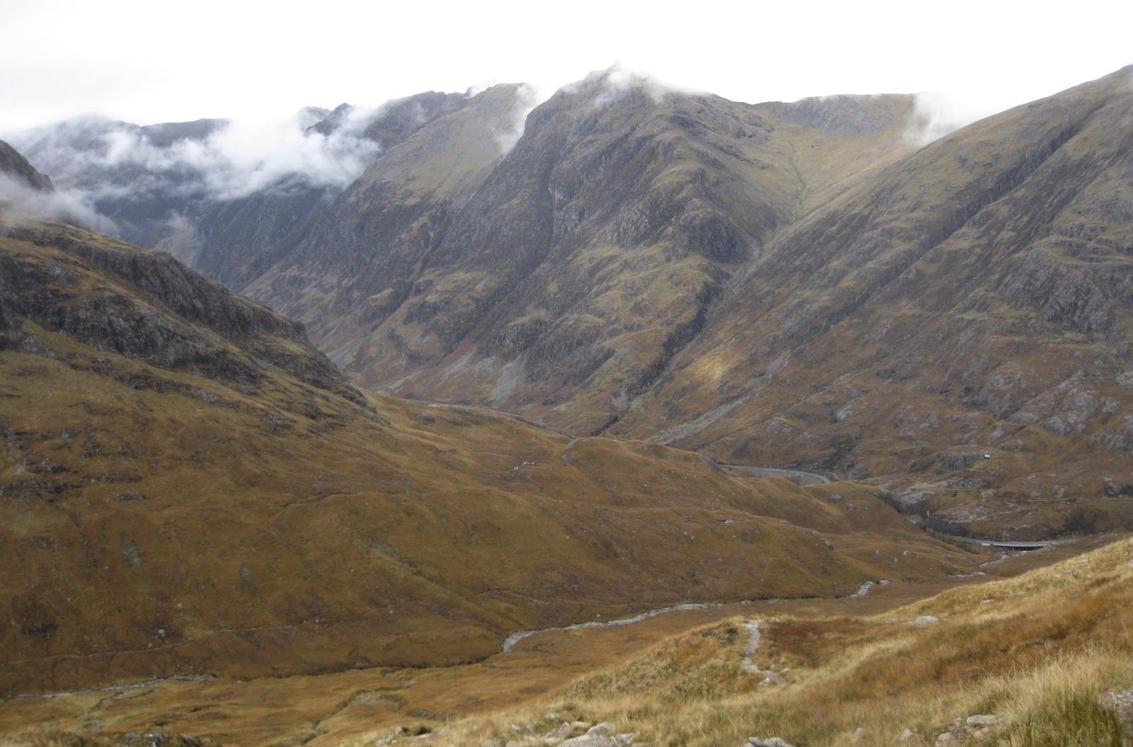
Glen Coe - Buachaille Etive Beag

In view of Leanne’s 5-train trek from Norfolk and the lack of readily-available lumpy mountain things in that part of the country, we opted for a modest first day.  Driving around to Glen Coe, we parked at 250m just above The Study and set off up a relatively new - and excellent - path that took us all the way to the skyline at the bealach that splits the short 2km-long ridge of Buachaille Etive Beag (little shepherd of Etive).


Stob Dubh From Stob Coire Raineach

Much of the ridge remained in cloud all day but there was no rain and we did get occasional views across to Buachaille Etive Mor and Glen Coe.  There are 2 Munros here, one at each end of the ridge, and it doesn’t matter which order you tackle them.  We opted for the southern end first and an easy 1½km of cloud-swathed ridge walking took us to the summit cairn of Stob Dubh (958m; black peak).  No view, but no problem – we were off and running and in the mountains!


Glen Coe

The pained roar of rutting stags was a persistent soundtrack to our short day in the clouds.  We retraced our steps to the bealach before tackling the short easy climb to our 2nd Munro – Stob Coire Raineach (925m; peak of the corrie of bracken).   The ascent of Buachaille Etive Beag offers one of the easiest, and certainly most straightforward, double Munro days in the Highlands.  As such, it’s a useful first or last day to keep up your sleeves on a trip to these parts!

Glenfinnan – Sgurr nan Coireachan & Sgurr Thuilm

For Day 2, we were thinking of tackling the serrated and pinnacled ridge of Aonach Eagach that borders the N side of Glen Coe.  However, thick cloud at dawn and the prospect of clambering along one of Scotland’s finest ridges in cold, damp and viewless murk prompted a rethink.  Accordingly, we headed west to Glen Finnan, home (thanks to H Potter) of the now famous eponymous viaduct.  Typically, no sooner were we on our way when the cloud started to clear but not before giving us some fabulous atmospherics as walked up the glen towards our 2 Munros.


Early Morning Atmospherics in Glen Finnan

There has been considerable hydro and forestry work going on up the glen so be prepared to see new tracks (roads really) everywhere as you wander up from the car park.  The start of the excellent stalker’s path up Sgurr nan Coireachan is clearly marked though (1½km beyond Corryhully bothy) and it’s still the best way of doing these hills i.e. clockwise.  All the clouds then disappeared and we were left with blue skies for much of the day.  Apart from nearly taking Fiona out with a loose rock half way up the climb, it was an uneventful ascent and there were no further near-death experiences as we continued steadily upwards!  


Lunch!

A spot of lunch by a delightful pool and then the first Munro of the day was ours:  Sgurr nan Coireachan (956m; peak of the corries).


Sgurr nan Coireachan

The connecting ridge to Sgurr Thuilm which is effectively the crest of the headwall to Glen Finnan is longer than it looks with quite a few ups and downs and the odd delicate step.  However, there are great views north over Glen Pean and the Rough Bounds of Knoydart and to the west to the Inner Hebrides.  A line of rusting fence posts help mark the way, not that we needed any help on this fine day.


Sgurr Thuilm

Soon after the penultimate hump of the ridge, you can bear left over open ground and take a direct line for the summit of Sgurr Thuilm (963m; peak of the rounded hillock).  Some thin cloud spoiled the summit views but we couldn’t complain.  It was then just a matter of following the long ridge down off the mountain, initially S and then SW over Druim Coire a’ Bheithe to the valley floor.  The path (greasy lower down) leads to the upgraded hydro track just before the new concrete sluice dam.  In failing light we traipsed wearily back down the main glen to the car under a stunning moon and increasingly starry skies.  A long (22km; 9 hrs) day, but very rewarding and with plenty to take in.  Best save it for some nice weather though! 

   
The Viaduct

Aonach Mor & Aonach Beag

Following the previous day’s exertions, we were all happy for something shorter and the ladies were also interested in trying out some winter navigation.  We left one car at the road-end in Glen Nevis and took the Nevis Range gondola to 650m before heading up the line of the Warrens ski run to the beckoning skyline.  The weather had turned decidedly wintery with a cold wind and a menacing threat of winter showers.  We reached the skyline in cloud but not before spotting ptarmigan and a mountain hare as well as evidence of pine martins from the occasional pile of undigested rowan berries!


Leanne Gets Her Winter Hillwalking Tick!

Soon after starting the micro-nav session on top of the mountain, however, everything changed and a ferocious snow shower swept in on the back of a ferociously cold wind.  This provided just a little too much realism for the ladies who nevertheless clung on to their maps and compasses to guide us straight to the diminutive summit cairn of Aonach Mor (1221m; big ridge). 


Ben Nevis

Then it was quickly on S in deepening snow (and lowering temperatures) to the bealach immediately before the short  steep climb up on to Aonach Beag (1234m; little ridge).  Navigation and blizzard demonstration over, we wasted no time in descending the mountain’s SW ridge and suddenly stepping out of the cloud to be greeted by wonderfully clear views across to Ben Nevis and the Mamores.


Clouds Clearing over the Mamores

We picked up the Glen Nevis path at Steall and descended through the gorge to the waiting car and some much-cherished heat!   


Beinn Teallach

Temperatures remained low and the threat of more winter showers and perhaps some sustained snow suggested a more straightforward day.  Accordingly, we headed E for the 2nd lowest Munro of them all which, with a reasonably high start-point, seemed to tick all the boxes.


Beinn Teallach

If a hill could be boring (which, obviously, they can’t be), this would be one of them!  The track through the forest from Roughburn gets you away from the trees and then an unproblematic river crossing and a squelchy path lead you to the corner of another plantation.  Here, the open hillside climbs uniformly for 500m to deposit you at a very shallow saddle and the choice of 2 cairns!  As ever, it’s best to take in both of them to guard against future surveys and re-classification!  We were rewarded with good views given that the expected winter showers failed to materialise.  That said, the brisk N wind ensured we were well wrapped up for most of the short day – Beinn Teallach (915m; hill of the forge).


The View South From Beinn Teallach

The return was a straightforward reversal of the upward route except for a tiny wee diversion through the woods where I just managed to avoid us being swallowed up by some very inconveniently placed quagmires!  Sorry girls; it seemed like a good idea at the time…..


Glen Nevis

With Fiona returning to Glasgow, Leanne was content to undertake a more modest walk along Glen Nevis to the ancient hill fort of Dun Deardail.  Unsurprisingly for such a fortification, this sits in a commanding position just off the West Highland Way where that route crosses into Glen Nevis at 330m.  Perfect – if cold - autumnal weather made for a pleasurable walk up through the forest accompanied by the occasional small bird sighting and associated birdsong.  Across the glen, Ben Nevis appeared to be unusually quiet for a Saturday morning and there weren’t many about on such a fine day.  Come early afternoon, however, and an ominous sheet of dark cloud appeared from the NW and rolled inexorably in replacing the blue sky, sun and frost.  Just after returning to the car the first raindrops appeared and by late afternoon in was fair persisting it down.  It was the only rain we saw all week!


Check out my future plans for this winter on: http://www.hillways.co.uk/winter/winter.htm