About Me

My photo
Hello! My name is Keith Gault and I've been tramping the hills of the UK and further afield for over 40 years now. This blog records some recent hill days undertaken either on my own, with friends, or with clients under my guided hillwalking Company: Hillways (www.hillways.co.uk). I hope you enjoy my diary; please feel free to comment on any of the walks. I will respond to any direct questions.

Saturday, 6 February 2010

Arrochar Alps III - Ben Vane

Ben Vane From Coire Grogain

It’s been a grey old day in the SW Highlands and a cold Caledonian wind has chilled me to the bone. I’ve been back again to the Arrochar Alps to climb Ben Vane, the second lowest Munro and the last of the Arrochar hills I am visiting third time around. It’s a good wee hill for a summer’s evening or a brief February day. I was stuck with the latter! The mountain is best accessed from the Inveruglas viewpoint half way up Loch Lomond (see the Ben Vorlich blog entry from November). Once again, the Hydro road up Coire Grogain leads you to the foot of Ben Vane quite comfortably and the day’s work – a fairly unrelenting steep 600m slope – presents itself in front of you after only about 45 mins from the car.


The Summit Cairn With a Distant Ben Lomond

Unlike some recent outings, there were quite a few walkers about; like me, wrapped up in windproofs in order to keep out that pesky wind! A well-marked path guides you up the steepness, a steady pace ensuring you soon gain height and win the impressive view back down the glen towards Loch Lomond and the hills to the east. Not today I hasten to add – cloud appears to have become my new hill buddy! Grassy slopes give way to more rocky terrain and after a few twists and turns around some rock outcrops, and a number of unhelpful false summits, you arrive suddenly at the top of the slope only 300m from the summit cairn of Ben Vane (915m; middle hill). Today’s climb passed quickly as the persistent cloud prevented any panoramic views from distracting me. The only time I really stopped was at the summit where a friendly group of club walkers from Glasgow proved good company for a while.

Then it was back the way I had come and I didn’t waste much time beating down that Hydro road to the comfort of the car and the warm embrace of it’s very efficient heater!

Ben Vane and Ben Vorlich From Ben Lomond


Check out my future plans for this winter on: http://www.hillways.co.uk/winter/winter.htm


Wednesday, 3 February 2010

The Jaws of Drumochter


All this snow and an unexpected opportunity to get out for a solo romp over some Munros conspired to have me driving up a strangely traffic-free A9 at a dark early hour. My target for the day was the group of 4 hills which lie immediately to the west of the Pass of Drumochter (462m) overlooking the A9. On earlier visits, I had climbed these hills over 2 separate days but I was determined that all 4 would go in this single short winter’s day. Given the high start, easy-going on frozen ground and the close proximity of the A9, I knew it could be done.

The Drumochter hills hardly rate amongst Scotland’s greatest but there’s really no such thing as a bad Scottish hill! Sgairneach Mhor is a typically rounded Grampian lump with 3 well-defined spurs extending from the summit plateau. It’s most impressive feature is a cliff-girdled corrie cradled in its northern slopes: Coire Creagach. Beinn Udlamain, the highest of the group is simply a long ridge oriented NE to S with a line of old rusting fence posts extending along its entire length. A’ Mharconaich would be undistinguished but for its NE corrie which gives a graceful yet dramatic appearance driving south along the A9 . Regrettably, Geal-charn (one of 6 Munros so named) has no redeeming corrie to offset its rather plain appearance. Nevertheless, all are fine walking hills and on this bitterly cold yet clear February day, they were well placed to provide a memorable day far from the madding crowd.

The View South From Sgairneach Mhor Towards Schiehallion

I parked and crossed the railway and headed west up the stalkers’ track into Coire Dhomhain. Few others were going to share my footsteps and I didn‘t speak to a soul all day. After 2 km of undulating walking over the moraine heaps in the lower glen, I struck left up the open flanks of snow heading for the north east ridge of the hill. The climb does not take long but just as I reached the skyline, cloud descended over the plateau and I was enveloped in a white world of cloud, snow and a chilly wind. Soon after, the summit cairn loomed out of the mist and I reached the summit of Sgairneach Mhor (991m; big scree) some 90 minutes after leaving the A9.

Far From The Madding Crowd

Although the traverse around and across the head of Coire Dhomhain towards Beinn Udlamain is straightforward in clear conditions, today would require care and precise navigation to ensure staying on course. Right on schedule the corrie appeared and the small lochan I was using to locate the line for Beinn Udlamain lay directly ahead! Mist obscured the skyline 200m above me and consequently, the impending climb appeared much more daunting than I knew it to be. So it was that after quite short a climb, the slope eased and the appearance of a line of broken and rusted fence posts led me to the summit cairn of Beinn Udlamain (1011m; jointed, or unsteady hill). All I needed to do now was follow the fence posts north and easy slopes would take me eventually to my 3rd Munro of the day: A’ Mharconaich.

The Ridge North From Beinn Udlamain Towards A’ Mharconaich

Out came the sun, away went the map and compass, and on I went over the frozen stones and snow along the wide crest of the ridge. In the gathering gloom I pressed on - and on - until the second of 2 cairns appeared out of the mist and I stood once again on A’ Mharconaich (975m; place of horses) with a great view suddenly revealed north to Speyside over the mountain’s dramatic NE corrie. Time and daylight were now pressing and I hurried back to where the path on to Geal-charn descends to the intervening bealach above Coire Fhar. Fresh footsteps in the snow helped confirm the line to take and the bealach duly appeared with my last hill of the day looming towards me with its summit just in the clouds. Geal-charn (917m; white hill) is the 6th lowest Munro but its ascent was the 4th of the day a rewarding achievement on a short winter’s day! Fortunately, the line of this mountain is quite straightforward and the going was again easy on hard ground. I descended directly towards Balsporran cottages, strangely dark and quiet although I knew them to be inhabited, as the main road and traffic noise edged closer and closer. Eventually I re-crossed the railway and immediately afterwards came upon the cottages. The lights were indeed out but there were plenty of signs of occupation which was good to see - the highlands have too many ruins.

I left the darkened cottages behind and found the cycle-way which I knew ran parallel to the A9 hereabouts. Walking south, somewhat closer to the road than I had hoped, the glare from the on-coming car headlights kept blinding me and I frequently had to pause until they passed. But slowly, oh so slowly, the dark outline of the Boar of Badenoch slipped by in the darkness and the Jaws of Drumochter gathered me in and pointed the way home.


Check out my future plans for this winter on: http://www.hillways.co.uk/winter/winter.htm


Saturday, 24 October 2009

Assynt & Coigach - The NW Highlands

Stac Pollaidh

‘Gloves’ Douglas was in town and was looking for some action. He had Weegie Girl tagging along with him. If there were hills to be climbed, she wanted in! So I found some hills for them and off we went to the far north-west of Scotland, to the ancient lands of Assynt and Coigach. The hills here are perfect two-thirds replicas of the mighty Torridon mountains further south and offer great hillwalking for less effort than your typical Munro. ‘Gloves’ arrived with his truckload of Red Bull determined to get up as many hills as possible and Weegie’s new boots looked like she meant business! Mind you, she normally does!

Ben More Coigach

Day One called for an easy walk-in, good views and not too much distance – Ben More Coigach fitted the bill admirably. This complex hill presents a solid wall of Torridonian sandstone to those driving north up the Ullapool road. In reality, this wall is but one side of a reclining horseshoe and the mountain actually comprises several distinctive tops, foremost of which is Sgurr an Fhidhleir (705m; peak of the fiddler) which sticks out a blunt uncompromising nose across the loch-strewn landscape to the north. We parked at Blughasary and walked up a good track for 3 km before cutting across country to climb Ben More Coigach’s eastern top, Speicein Coinnich (717m). This entailed an interesting but successful river crossing which everyone achieved without mishap! Once on top the long ridge stretched out towards the sea and the Summer Isles glistened in the autumnal sunshine. The actual summit of Ben More Coigach (743m; big hill of Coigach) lies just north of the main ridge. The going is very easy and the traverse of the main ridge is full of interest. As you work your way down to the south-western top of Garbh Choireachan (733m), the ridge becomes a narrow scramble over sandstone pinnacles all of which can be by-passed on a good path on the northern side.

Approaching Garbh Choireachan

We returned the same way enjoying great views all-round, but particularly to the north where all of the following week’s hills could be seen stretching away towards the top of Scotland. This was Gloves’ first outing with trekking poles and it was only late in the day that we became aware of how like Brad Pitt they made him look. Brad Pitt playing Benjamin Button that is! Once he was shown how to extend them beyond the 3 feet length he had seemed happy with, all was well and he was able to walk quite upright! That said, his slow motion back-flip into a peat bog was executed with great aplomb! Some people are just so ostentatious and attention-seeking on the hill don’t you think?

Stac Pollaidh's Crumbling Summit Crest

The next day saw us tackling Scotland’s finest wee hill – Stac Pollaidh (612m; steep rock at the pool). This diminutive, but spectacularly attractive prominence is a crumbling ridge of sandstone surrounded by steep heather-covered scree slopes that give it a somewhat volcanic – and extremely photogenic - appearance from the east. Stac Pollaidh stands only a kilometre north of the twisting single-track road to Achiltibuie above Loch Lurgainn. An excellent path climbs and curves around the eastern side of the mountain and on to a saddle on the summit crest. Once on top, it’s just (did I say just?) a scramble along the ridge over, along and around a series of sandstone pinnacles until a final ‘difficult step’ suddenly throws down a challenge to those uncomfortable with slipping, falling and death! The small tower that now blocks the way looks worse than it is but caution is definitely advised even though the actual summit of the mountain now lies only a few metres beyond. Today, a ferocious wind persuaded us that retreat was the better part of discretion and we retired back along the ridge in no way feeling short-changed such was the entertainment value (and challenge) of the rest of the ridge.

'Gloves' Ponders the Difficult Step With A Secret Admirer!

Rather than return by the upward path, we picked up a continuation of the path that circles the whole hill thus allowing close scrutiny of the entire summit ridge from below. Stac Pollaidh offers a short day and is an ideal ‘stocking filler’ in between the bigger mountains in the area. It is always interesting and never palls no matter how many times you scramble along that crumbling pile of sandstone. Be quick though; devoid of its protective quartzite cap, the mountain’s sandstone is eroding rapidly and the elements are busy remodelling the pinnacles - they wont be there for ever!

Cul Mor

Our third hill day took us to the highest peak in Coigach, Cul Mor (849m; big back). From a lay-by below Knockan Crag 3km south of Elphin, a good stalkers path leads across country before climbing gradually up gently sloping quartzite strata to the subsidiary top of Meallan Diomhain. Here, the underlying rock changes to the familiar Torridonian sandstone and the summit cone of Cul Mor rises up directly in front of you. This can be tackled head on up steep mixed ground or, more usually, by crossing a small plateau and ascending Cul Mor’s north-eastern ridge. This provides not only a welcome path, but also good views across to Suilven – the pride of Assynt – and the impressive Coire Gorm (blue corrie) whose cavernous recesses drop vertically from the summit of the mountain. Take care approaching the summit as you once again encounter the quartzite in the form of tricky-sized boulders which demand care, particularly when wet. Once on top, however, no further difficulties should be encountered.

A Weak Attempt at Hiding on the Summit of Cul Mor!

When climbing Cul Mor, do make the effort to walk the near-level kilometre along the mountain’s north-western ridge, Sron Garbh (rough nose), to a spectacular viewpoint over the Inverpolly National Nature Reserve. This vast empty area of ‘lochan and knockan’ landscape sits on underlying Lewisian Gneiss, some of the oldest rocks in the world at 1500-2500 million years of age, which surprisingly predates even the X-Factor! Those envisaging an exploration of this remote and watery land would be well advised to consider asking Santa to bring them a canoe for Christmas! The return to the car reverses your route back along Sron Garbh to a gravelly bealach between Cul Mor and its twin top Creag nan Calman (828m; crag of the dove). This can be climbed for completeness before descending eastwards back over Meallan Diomhain to the stalkers path.

Quinag on a Sunnier Day

Day 4 took us to the northern edge of Assynt and the wonderful 3-Corbett triptych that make up Quinag (milk pail). The complex Y-shaped collection of peaks and ridges looks particularly impressive when approaching from the north over the graceful curve of the Kylesku Bridge. However, the mountain is most accessible from an old quarry car park just below the summit of the watershed between Loch Assynt and Kylesku. This gives a relatively high start and a good stalkers path (currently undergoing well needed repairs) to follow initially before cutting across to pick up the easier slopes of the mountain’s southernmost peak and first Corbett, Spidean Coinich (764m; peak of the moss). This entertaining climb ascends over gently sloping strata of quartzite before dipping slightly followed by a final steep climb up to the summit. Today, this became a real battle against a remorseless buffeting wind and it was a real struggle to fight our way to the summit cairn which is perched right on the edge of the peak’s northern face. We were getting quite angry with the wind now so wasted no time in moving on in search of some shelter. As expected, once below the summit cone we entered a zone of calm which enabled us to stand upright and engage in conversation again, let alone walk properly! Regrettably, the thick cloud precluded our full enjoyment of the usually entertaining central spine of Quinag and we didn’t see anything until well down the mountain. A comfort break whilst ‘Gloves’ went off in search of a fully-flushing WC (or so it seemed given the time he took) ensured Weegie and I cold-soaked for just a bit too long. The resultant warm-up exercises in the form of a stylish hip-swerving dance thing (with impressive use of trekking poles for visual effect) was gleefully captured on video by ‘Gloves’. He will publish it on Facebook at his own peril.....!

!
Not For General Release!
The continuing dreich failed to convince us that the complete traverse of Quinag’s ridges and 2 other Corbetts would be worth the misery so we turned off at the Bealach a’Chornaidh and followed the stalkers’ path back to the car. Quinag is a great mini-massif, full of entertainment and interest. It is worth keeping for a good day, or at least a day of clear tops so the intricacies of the mountain can be enjoyed and appreciated to the full. It also comes complete with a fully-flushing loo – allegedly!

Brocken Spectre

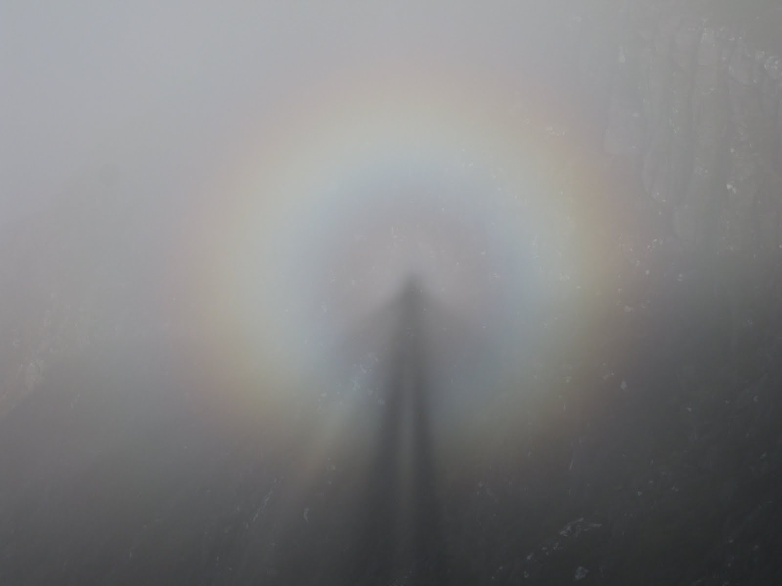
For our last day, we decided to climb Cul Beag (769m; little back). This hill provides a good half-day with a short walk-in and modest climb whilst giving great views over the Coigach peaks. A larger than usual passing place 3km along the Achiltibuie road from Drumrunie provides a useful start for a fairly damp pathless trudge up a soggy corrie to the 500m level. Here, the going gets easier over a sandstone pavement until the upper mountain appears and a steep climb takes you up the final slopes to the summit. Swirling cloud and bright sunshine conspired to give us a great view of our brocken spectres – rainbow-coloured halos which encircle your own shadow and which are a familiar sight in such conditions. ‘Gloves’ was much impressed!

This was a great week with great companions who were a real pleasure to walk with. Check out my future plans for similar walks on: http://www.hillways.co.uk/summer/summer.htm

Saturday, 26 September 2009

The Pyrenees


Professor Higgins may have known a thing or two about phonetics but his understanding of Spanish meteorology was clearly flawed: the rain in Spain does not fall mainly on the plain. Neither does the snow! Our 5-day trek through the Pyrenees (and back again) gave us all 4 seasons with a healthy dump of snow to keep our minds focussed and our sun tan lotion firmly in our sacks. All turned out well in the end though and the trek ended with a memorable descent in hot sunshine through classic alpine pastures to a waiting ice cold beer on a sun terrace that required no ice axe!

The trek was based upon the French Pyrenean village of Gavarnie, seemingly the most visited village in the Pyrenees. Whilst it is a relatively small and unassuming place, it lies close to the head of the Gavarnie valley whose headwall is crowned by the very impressive Cirque de Gavarnie. This vast amphitheatre of vertical rock carries along its skyline the main Pyrenean watershed and international border between France and Spain. This impressive scene is further enhanced by Le Grand Cascade, Europe’s highest waterfall at 243m.

All We Got to See of the Cirque de Gavarnie

The trek started easily enough with an hour’s stroll up the busy mule track towards the Cirque (just follow the droppings). We stopped briefly at the Hôtellerie du Cirque, a rather drab square building which served up a fairly unimpressive lunch as we waited for the rain to start falling – which it duly did just as we left for the climb to the Sarradets Hut. The key to the climb via the steep Échelle des Sarradets route is a narrow path seen rising gently to the south-western corner of the Cirque. This scrambles up steep rock terraces with the occasional help of in-cut steps in the rock before the slope eases on the approach to the refuge. Regrettably, we were soon immersed in thick cloud and were denied any view across the towering cliffs of the Cirque. Painted flashes on the rocks mark the way up the terraces but seemed to disappear as we entered a broad rock-filled gulley with increasing snow patches and a marked drop in temperature! Eventually we reached the Col du Sarradets only to discover we couldn’t find the hut! How embarrassing! Thankfully, after a short ‘this way then that way’ search in the gloom, the square outline of our sanctuary suddenly materialised and we duly arrived at the Refuge des Sarradets (2587m). The hut is basic and modest but is well placed for the short climb to Spain which was to be our destination in the morning.

Approaching the Brèche de Roland - in Summer!

And that morning brought a continuation of thick cloud and a generous layer of fresh snow covering all the rocks. Mid-September felt very strange! After picking up the world’s most expensive packed lunches (er, I mean dry sandwich and apple), we filed up the steep snow slope behind the hut wearing almost everything we had been carrying in our rucksacks. We knew that just above us lay the Brèche de Roland (2807m), a huge gash in the frontier ridge between France and Spain. This was to have been one of the highlights of the trip but as it turned out, the most impressive thing about it was the way I almost broke my nose bumping into it! Still, the weather was bound to be better when we were to return a few days later.... Once in Spain there followed a tricky descent over snow-covered boulders of various sizes which concentrated the mind somewhat! Eventually, the sun finally broke through and the snow melted away to reveal a surprising number of edelweiss clinging on to the last vestiges of summer. We also saw the first of many, many chamois, a usually shy member of the antelope family which seems to have shed its inhibitions in this part of the Pyrenees. Marmots too were very much in evidence as they scurried about trying to grab a last bit of food before their long hibernation.

The Ordesa Canyon

A circling traverse over limestone terraces brought us at last to bright blue sunshine and the northern rim of the very impressive Ordesa Canyon. This we followed above the towering sandstone cliffs whilst bearded vultures or lammergeiers soared overhead to our home for the next 2 nights: the busy, but well equipped, Refugio de Goriz (2170m). This popular hut is the only manned refuge within the Ordesa National Park and it shows! It will certainly benefit from a new building and facilities which are currently under construction and due to open in 2010.

Day 3 started cool with cloud on the tops and we wasted no time in starting up the well-cairned path which was to take us to our goal for the day: Mt Perdu (Mt Perdido to the Spanish; 3335m). The path climbs up and over a series of grass and rock terraces until you come to a very British mountain scene – a small glacial lake, Lago Helado. Today this marked not only a sharp right turn in the route, but also a change in seasons. Suddenly we were in full winter conditions as we climbed through the gloom, first along a thin rocky ridge and then steeply up a broad snow-filled gully. The snow was soft enough to preclude the need for ice axes and crampons and we had the advantage of other climbers’ boot-steps which prevented the climb from becoming an unremitting slog up to an unseen skyline. Eventually though, the slope eased and a snowy saddle led us on to the final summit pyramid and the fairly modest summit of the third highest mountain in the Pyrenees. No view of course but that didn’t detract from the elation of achieving one of the main aims of the trek, particularly in very challenging conditions. We returned to the hut by the same route to be greeted by hot early afternoon sunshine which called for a few hours’ sunbathing and a welcome respite from walking with a sack. Another night in the Goriz Hut enabled us to once more sample the delights of a large number of fellow humans attempting to sleep the night away in close proximity!

The Summit of Mt Perdu

The next day promised to be the highlight of the trek with a traverse of the southern cliffs of the Ordesa Canyon, a steep descent to the canyon floor and a long climb back up and over the Brèche de Roland to the Refuge des Sarradets. In the event, things turned out rather differently – although the day ended well and in some comfort! From the hut, a gradual descent leads to a rock step which forms the canyon’s headwall (the Circo de Soaso) down which the path zig-zags before picking up the 1900m contour which it then follows. This path is known as the Faja de Pelay. As the canyon floor descends, you end up getting higher and higher above the fast-flowing Rio Arazas and views start to open out northwards towards the main Pyrenees watershed.

Mt Perdu & the Ordesa Canyon Headwall

Three hours from the Goriz hut and shortly after pausing at the Mirador de Calcilarruego, a small walled viewpoint which offers spectacular views in all directions (including vertically downwards), a steep 600m descent leads down to the canyon floor where a convenient bridge provides the crossing point for the river. Our plans to climb up to the Brèche were dealt a mortal blow when 2 groups coming the other way announced that the climb out of the northern side of the canyon involved not a steep path with chains (clavijas) for assistance, but full-on via ferrata for which we were not at all equipped. After some rapid re-planning and with the help of some local park rangers who just happened along, we decided to retrace our steps back to the canyon floor and follow the GR11 footpath to the western part of the Park and aim for a small refuge at Bujaruelo. This all worked like clockwork and the day ended with us ensconced in a very comfortable accommodation with comfy beds, a choice of food and an operating bar! Sheer luxury lad!

Canyon Colours and Autumn Shades

Our final day was reminiscent of a Scottish glen with a steep climb up through a hanging valley to a high pass (Port de Boucharo) and a re-crossing of the French/Spanish border. The trail resembles a Highlands stalking path as it zig-zags up grassy slopes. As we approached the col the apparently random flight of a few butterflies materialised into a steady stream of them flying quite purposefully over the border. It was André (who is an authority on such matters) who pointed out that this col is a high point on a key migration route for winged creatures heading to Africa for the winter. So deliberate was their flight that we had to duck occasionally to avoid them flying into us! There followed a memorable descent in bright warm sunshine down through the grassy Vallée des Pouey Aspé, across the delightful Plateau de Bellevue and down finally into Gavarnie itself.

Vallée des Pouey Aspé

This 5-day trek takes in all the major scenic features of this part of the Pyrenees: the Cirque du Gavarnie with Le Grande Cascade, the Brèche de Roland and the Ordesa Canyon. For good measure, the ascent of Mt Perdu adds an interesting climb to an already impressive trek. But don’t forget your ice axe, particularly in summer!


Check out my future plans for similar walks on: http://www.hillways.co.uk/alpine/alpine.htm

Thursday, 16 July 2009

Swiss Alps - Zermatt

Castor and Pollux

Having relocated to Zermatt from Zinal (see previous entry), the plan was to continue with fitness and acclimatisation walks with the eventual aim of climbing one of the 4000m snow peaks in the area and even perhaps the mighty Monte Rosa, the second highest mountain in the Alps! One day was spent on ropework and basic climbing/glacier crossing techniques, and another rockclimbing on the Rifflehorn (2927m) where the local guides like to take their prospective Matterhorn clients to check on their basic climbing skills. Our plan to climb the Monte Rosa was scuppered by poor weather but we managed a further 3 days of alpine walking which included a near success on one of the 4000m peaks above Zermatt.


Oberrothorn (3414m)

Not a very photogenic mountain but a useful one for acclimatisation! A quick ride up the Sunnegga funicular railway deposited us above the tree line in bright sunshine. This put us in excellent shape to traverse through classic alpine walking terrain to the Fluhalp Hut (2616m) for drinks various and a welcome breather before the real climb of the day. From the hut, a ski track leads up through a rock-strewn landscape to a windy col just below 3000m where some small lingering snow patches entertained the party. Then it was up a well-engineered path that climbs steadily up to the rocky belvedere of the Oberrothorn from which wide views open out in every direction. On returning to the col we climbed up over the Unterrothorn (3103m) before descending down a tightly zig-zagging path and back to Sunnegga. The Unterrothorn is a good location to take in the sunrise over the Zermatt skyilne following a short nighstop at the Fluhalp Hut.


Mettelhorn (3406m)

No leisurely walk-in today, let alone welcoming funicular! No, just turn left in the High Street and climb, climb, climb! This is a minimum 8hr day involving almost 1800m of climbing. And it’s a steep, unrelenting climb as well up past the Edelweiss Restaurant and up into the Trift gorge. Fortunately, our fitness and acclimatisation programme was working and the height was gained reasonably comfortably. In a little under 2 hrs we were at the Hotel du Trift, a large mountain hut with a stunning location below the Ober Gabelhorn and Zinalrothorn. Here, the path turns right and continues climbing to an exposed col above the Hohlicht glacier at just above 3100m. The upper reaches of the climb were covered in late spring snow and a cautious detour eliminated much of the good time we had made in our workmanlike ascent! From the col, the Mettelhorn finally comes into view – a rock pyramid situated 800m across a snowfield which, although generally tame, deserves prudent respect in case of any lurking crevasses. The Mettelhorn gives excellent views down the Mattertal, effectively the Zermatt valley, as well as a front row seat of the mighty Weisshorn, one of the Alps’ most graceful (and highest) peaks. We returned the same way, foregoing any refreshment at the Hotel du Trift in favour of hot chocolate and carrot cake at the Edelweiss!


Castor (4223m)

The mountains will always be there tomorrow; the secret is to make sure you are! A climber who sets out with those wise words firmly lodged in his mind, will never let a sense of failure cloud what would otherwise be a quality mountain day! Thus it was that our unsuccessful attempt at Castor remains as a positive memory of a great day out surrounded by snow, ice and rock with much of it spent close to 4000m. In order to limit the climb to one day, we took the Klein Matterhorn gondola up above the ski slopes and started the glacier traverse from the top station at 3817m. Bedecked with climbing harnesses, helmets, ice axes and crampons, our small party of family and friends roped up and trailed over the Breithorn Pass, traversing below the Breithorn and Pollux until we stood at the foot of the snow dome of Castor, one of the easier 4000m alpine peaks. All the time, however, dark clouds were approaching from the west and as we began our final climb heavy snow showers could be clearly seen over the Zermatt valley. Just after passing the 4000m point in our steady plod up the final icy slope to the summit we called a halt and turned to retrace our steps back to the gondola station. We still had 45 mins to go to the summit, a further 2 hrs for the return and the weather didn’t look like it was going to do us any favours. Under the circumstances, it was a prudent if disappointing decision. At least the day gave the group good experience of the factors involved in tackling the higher alpine peaks and proved to be a useful introduction to glacier travel. The views weren’t bad either – we even got to see Mont Blanc before the clouds rolled in!


Check out my future plans for similar walks on: http://www.hillways.co.uk/alpine/alpine.htm

Wednesday, 8 July 2009

Swiss Alps - Zinal

The Zinalrothorn and Besso High Above the Zinal Valley

The first part of the Hillways’ annual foray to the Swiss Alps involved 2 days in the Val d’Anniviers based in the small, but well-placed village of Zinal which is perched at the end of the road in this easternmost part of the French-speaking part of Switzerland. There is only one cable-car in Zinal so you have to work for every bit of your height if you want to get close to the numerous high peaks that encircle the head of the valley. You are only a stone’s throw from Zermatt but the short walk between valleys would involve a challenging blend of rock, glacier and 4000m peak - so most prefer to take the car!

Besso (3667m)

Day 1 threatened to alienate the illustrious leader from the group as I led them straight past the gondola station and straight up the steep 800m slope over which the Sorebois cable car effortlessly glides! This was as much to do with fitness and acclimatisation as it was to save money and I’m sure the others appreciated that fact (if ony they’d said as much)! Once above the tree-line we traversed south along a delightful alpine path that should have afforded spell-binding views of the mighty Weisshorn, Zinalrothorn and Ober Gabelhorn, alpine giants that form the eastern skyline of the valley. Today, however, cloud intervened and denied us all but a glimpse of these alpine monsters. A 2-hr traverse high above the valley floor and across a decidedly dodgy-looking band of recent landslide debris brought us to the green pastures of La Lé and an easy descent to our first mountain hut of the trip, the Cabane Petit Mountet. This hut is perched precariously on top of the crumblimg lateral moraine of the rapidly receding Zinal glacier but a comforting hot chocolate helped take my mind off the implied state of the hut’s foundations! An hour’s leisurely descent in steady rain returned us to the welcoming ambience of the Auberge Alpina in Zinal.

Starting up the Pas du Chasseur

Day 2 started with more rain and some unseasonal fresh snow down to 2000m which precluded the planned climb to the Col de Milon via the yet-to-be-visited Cabane d’Arpitetta. Instead, we opted for a short walk back up the valley to locate the chain-assisted scramble up the Pas du Chasseur so we could get used to some exposed rock and basic ropework. The climb falls well short of graded via ferrata (the ascent of exposed rock walls using in-place ladders, chains and assorted ironmongery), but is nontheless an interesting introduction to assisted ascension techniques! A couple of hours of various ups and downs using the chains gave us some useful and entertaining introduction to steep ground by which time the sun came out and we headed back to begin our transfer around to Zermatt for the rest of the trip.

Lunch Beside La Napisence

Check out my future plans for similar walks on: http://www.hillways.co.uk/alpine/alpine.htm

Monday, 8 June 2009

Return to Skye - Black Cuillin

Cuillin Ridge - Southern Section

Early June saw good weather this year in the NW Highlands and on Skye. Fair weather and a brisk wind dried out the Cuillin Ridge and made for excellent walking, scrambling and climbing conditions. Dr Darren was kept busy with a steady stream of clients and I went along to see the great man at work guiding Frank over the southern part of the Ridge on a day encompassing 4 Munros and an infamous rock climbing obstacle!

Starting from the Glen Brittle campsite on a gorgeous morning, we had only been walking about 15 minutes when Darren declared a snake in the grass – an adder! Sure enough, there at our feet silently weaving its sinuous way across the path and into the grass was a living breathing example of Britain’s only poisonous snake! Having failed to persuade the good Doctor to pick the thing up so we could get a decent photo, it was left to Frank and I to snap away as it made its escape. Our best effort is here:

Adder! (you'll have to use your zoom to see it)!

After all this excitement the rest of the walk up and into Coir’ a’ Ghrunnda had only the Doctor’s erudite observations on dubious geological titbits or even more dubious looking climbs to entertain us. Frank and I did our best to look interested whilst dreaming silently of joining the Ramblers Association! Fortunately, those strange thoughts soon passed and before we could tie a map-case around our necks we found ourselves imparting some route-finding advice to some (very pretty) European neighbours who were unsure of the best way through the rock landscape. Then it was up to the lochan high in the corrie, pausing at the ‘ringing rocks’, a hollow sounding igneous rock which lets out a surprising musical ‘ting’ when tapped. A short, steep climb took us up on to the ridge itself and a short walk led to the first Munro: Sgurr nan Eag (Notched Peak, 924m).

After surveying the wide expanse of sunlit sea and islands to the south and west, not to mention the distant peaks of Knoydart and Kintail, we commenced our hours of joyful scrambling up and down and along this finest of all British mountain ridges. Copious use of the hands and arm muscles do take some of the strain off your legs but it is still hard and thirsty work and the rough rock (great for grip) takes its toll on soft hands and fingertips. Cuillin Finger can stay with you for days if you aren’t a regular member of a chain gang! Retracing our steps and continuing along the ridge, we contoured around the rock tower of Caisteal and climbed steadily up to the musically sounding Sgurr Dubh na Da Bheinn (sounds like Sgurr Doo na Darven; Black Peak of the Two Mountains, 938m). Here we had to leave the main ridge for a short detour to capture the second Munro of the day: Sgurr Dubh Mor (Big Black Peak,944m). The latter is only 6m higher than its sibling on the main ridge but its best not to dwell on such statistics as you spend the best part of an hour clambering down from the ridge and up a series of complicated terraces and gulleys to capture the Munro – before going all the way back again!

Last Smile Before the TD Gap!

This minor inconvenience, however, was nothing compared to the fiendish Doctor’s next treat. A little way north of Sgurr Dubh na Da Bheinn, and without any prior warning whatsoever, one’s confident progress along the ridge is abruptly halted by a deep gash of what looks suspiciously like fresh air in front of you. This is the infamous Thearlaich-Dubh Gap (usually referred to as the TD Gap).

The south side of this ‘challenge’ (you can guess who called it that) is a 30’ vertical wall whilst the northern side stretches to 80’ and is just as vertical! I looked at Frank, Frank looked at me; nobody looked at the Doctor! It didn’t matter, he was quite intent on forcing us to take up religion (it didn’t last) as he set up his belay to lower us down into this horrendous looking defile. Once down, the way up the other side looked just as improbable (sorry, impossible) as it had done from the top of the southern wall. The next 45 mins was a bit of a blur but largely consisted of me sitting in this cold, damp and very dismal wind tunnel as McAulay hustled his way up the smooth-sided chimney groove that represents the escape route out of this charmless spot.

Climbing Out of the TD Gap

It’s not a pretty climb even by an expert (none of those around from what I could see) but eventually his nibs announced success. Having set up a belay, he then coaxed, cajoled, tempted and otherwise bullied poor Frank up the same polished rock whilst I slowly succumbed to hypothermia. Regrettably, I was still alive – just – when it was my turn to scamper up after them! I’m not sure if scamper accurately describes the Gault patent method of chimney groove climbing technique. Sufficient to say that after a series of huffs, puffs and fairly inglorious scrabbling for spitefully placed handholds and out-of-sight footholds, I was up and back into the land of sunshine and horizontality!

Sgur Alasdair

The ascent of Skye’s highest peak was always going to be a doddle after this and sure enough, a short walk from the TD Gap brought all 3 of us to the Cuillin’s highest point: Sgurr Alasdair (Alexander’s Peak, 993m). On a good day you can see St Kilda from here way out in the Atlantic to the north-west. Ben Nevis, in the other direction, appears to be almost a close neighbour in comparison. Alasdair is a fine sharp-pointed summit with dramatic close-up views down into Coire Lagan to complement the impressive distant landmarks. The Inaccessible Pinnacle of Sgurr Dearg is in clear view now, its wafer-thin vertical wedge of rock inviting those who have survived the TD Gap towards their next big adventure!

Innaccessible Pinnacle

From Sgurr Alasdair we descended to the top of the Great Stone Shoot – a popular, if unappealing loose-scree route up and down this mountain – before traversing over Sgurr Thearlaich (Charlie’s Peak, 977m). Not a Munro, but nevertheless a fine roof-top summit ridge best done (as I have always done it) in warm, early evening sunshine. A complicated scramble leads down from the end of the roof to a small break in the ridge before the final Munro of our day: Sgurr Mhic Coinnich (Mackenzie’s Peak, 948m). This peak can either be tackled directly up another of those improbable-looking chimney-corners or, as Frank and I chose, by the much more pleasing traverse along Collie’s Ledge before doubling back along the ridge to the summit.

Collie's Ledge

All we had to do then was carefully weave our way down into Coire Lagan before striding manfully off into the setting sun and the green fields of Glen Brittle. The day took almost 11 hours which illustrates how deceptive the Cuillin can be. The distances may not be great, but everything takes time and throw in some rock climbing and associated ropework, and you know you’re going to have to rush for your steak and chips and celebratory dram of Talisker at the Old Inn in Carbost!

Sgurr Mhic Coinnich and Sgurr Alasdair From Glen Brittle

Check out my future plans for similar walks on: http://www.hillways.co.uk/summer/summer.htm