About Me

My photo
Hello! My name is Keith Gault and I've been tramping the hills of the UK and further afield for over 40 years now. This blog records some recent hill days undertaken either on my own, with friends, or with clients under my guided hillwalking Company: Hillways (www.hillways.co.uk). I hope you enjoy my diary; please feel free to comment on any of the walks. I will respond to any direct questions.

Wednesday, 20 October 2010

Climbing in France

As the sun heads south for winter and the days start shortening I just managed to squeeze a few days with the rock god of the Ecrins National Park in the French Alps. Following the previous week’s exertions tramping over the length and breadth of the Cairngorms, more hill-walking was not high on the agenda. Instead, and much to the good doctor’s pleasure, we close to get up close and personal to some French rock.

First up was a local via ferrata (Italian = iron road), a system of ladders, rungs and cables that are run up vertical rock faces to enable mere mortals like me to put there soft pink bodies where they have no earthly right to be! They were developed by the Italian army to help wage war against their Austrian counterparts in the South Tyrol, particularly the Dolomites, on the Austrian/Italian border (a moveable boundary for some of the 20th Century)! The doctor knew of a suitable local cliff to start on, it’s only disadvantage being it’s position on the shadowy side of the valley. At this time of year you need all the warmth of the sun you can get. Having donned our via ferrata climbing harnesses and strained our necks peering up at our stairway to heaven, I followed the man up the ironwork pretending I wasn’t at all phased by the rapidly disappearing valley floor below my feet! The GR54 long distance footpath runs close to here but there were no witnesses to my deft climbing skills alas! Half way up we changed over and I was given the honour of leading us out into the bright (and, thankfully, warm) sunshine! That was quite enough for one day so it was back to the car and off to find a restaurant so I could start boring folk with my tales of derring do high on a sheer cliff face.

A day and autumn storm or two later, the sun came out again and the doctor decided it was time to return to the rock, but this time without any accompanying ironwork! So we drove south and found a suitable (completely hold-less), sun-kissed (hot), and accessible (5 mins walk from the car) crag on which to spend the afternoon posing for photographs. There followed a series of climbs of French Grade 4/5 standard which typically took the good doctor no more than 5 mins and yours truly about half-an-hour to complete! It was all very enjoyable until I lost the use of my arms through chronic fatigue having used them to cling to the rock all afternoon!

It was the last of the sun – and the heat – for the week, and probably the year. It certainly was for the doc who is about to leave for his 3 months stint on the ice of Antarctica – which was almost the same amount of time we experienced snow for in much of Scotland last winter. What will this winter bring? Better days, that’s for sure...

Check out my future plans for this winter on: http://www.hillways.co.uk/winter/winter.htm


Monday, 11 October 2010

The Cairngorms in Autumn – The Cairngorm 4000ers

The High Peaks of the Western Cairngorms

There are 9 separate mountains accorded Munro status in Scotland above 4000’. Five of these lie within the Cairngorms massif and they constitute 5 of the 6 highest mountains in the British Isles. Because Pete needed to do them and because Andy didn’t stop me, I suggested doing them all in one day (and half of the night as it transpired)! The ensuing mountain marathon proved many things: the wisdom of carrying head-torches at all times, the perils of combining big hands with small maps and just because someone says they have a good idea it doesn’t mean you have to do it!

The Kincardine Hills From the Northern Corries of the Cairngorms

But hey, what else was there to do? The brilliant autumnal weather was continuing and we had enjoyed the previous day above Glen Feshie so we went for it. And what an endurance test it proved to be – 14 hrs of walking, climbing and stumbling over the highest upland massif in the land. We’ll be using the winter to recover!

The View West From Cairn Gorm

We started from the Cairngorm ski car park and headed up through the skiing detritus and under the funicular railway where we were overtaken for the only time during the day - by the first train of the morning. We sped past the Ptarmigan restaurant top station and up the flagstones to the summit of Cairn Gorm (1245m; blue hill) all of which took just over an hour. The views ranged from Ben Wyvis and the distant Fannichs to the north-west to Beinn a’ Ghlo in the south and Creag Meagaidh and the Laggan hills away to the west.

Descending Cairn Gorm; Only 6 Munros to go!

The summit was ours alone at this early hour but we had much to do and descended without delay westwards before traversing the rocky rim of Coire an t-Sneachda. From the top of the goat track we struck out across the plateau in glorious sunshine before pausing for some early lunch beside wee Lochan Buidhe (green lochan) the highest named tarn in Britain. Near here in November 1971, a party of 5 schoolchildren and their assistant instructor from Ainslie Park High School in Edinburgh perished in a snow blizzard. The tragedy led to the removal of nearly all mountain refuges in the Cairngorms as it was felt their presence could encourage walkers to press on in bad weather. These sobering thoughts seemed a world away in the warm sunshine as we continued south up the boulder-strewn slopes that led to our second peak of the day: Ben Macdui (1309m; hill of Macduff). More folk were about now, as were the snow buntings, and we barely paused at this 2nd highest peak in Britain before heading onwards.

The View South From Ben Macdui Towards Distant Beinn a'Ghlo

We descended south to pick up the Tailor burn, named after 3 tailors who died in snow one New Year’s Eve in an attempt to dance a highland reel on both Deeside and Speyside during the same night. The burn’s left bank took us to a small saddle connecting Ben Macdui with our 3rd Munro of the day (a late addition for Pete’s benefit) Carn a’ Mhaim (1037m; hill of the pass). The summit is placed rather inconveniently at the southern end of the mountain’s 2km summit ridge but it eventually came our way and suddenly we were about to turn and head back towards the car instead of continuing on to Edinburgh which felt just as close!

Braeriach, the Lairig Ghru & Ben Macdui From Carn a' Mhaim

Below us the mighty defile of the Lairig Ghru the finest mountain pass in Britain led north over its 835m summit to Strathspey. Immediately beneath our feet, 500m below us on the valley floor, lay the conspicuous shiny roof of Corrour Bothy surrounded by it’s bright green moat of grass. This former deer-watcher’s cottage was built in 1877 and the last watcher left in the 1920s. We moved a little south from the summit before exploiting a break in the mountain’s western wall of crags to commence a descending traverse into the southern entrance of the Lairig Ghru.

The Lairig Ghru

High mountains towered all around us now, a sobering sight given that we still had to climb most of them! We paused at the footbridge carrying the path to the bothy for some food and a cold soak in the waters of the infant Dee. At 3.30 on this mid-October afternoon (hell of a time to start climbing a mountain) we paused briefly to inspect the bothy’s new facilities before beginning the steep climb up into Coire Odhar and onto yet another Munro, the euphemistically titled Devil’s Point (1004m). The original gaelic name inferred a more phallic translation and was changed to appease Victorian virtues! This is a splendid viewpoint which gives great views in all directions the least inspiring one being that to the north that heralded our next big climb up on to Cairn Toul.

The Devil's Point Towering Over the Corrour Bothy

A definite evening feel to the day accompanied our short descent from the Devil’s Point and immediate climb to the 1213m top overlooking rock-strewn Coire an t-Saighdeir (corrie of the soldier) before a short descent and re-ascent on to the short summit ridge of Cairn Toul (1291m; hill of the barn). This mighty peak, the 4th highest mountain in Britain and the sharpest of the high Cairngorms, acts as a high watchtower over the southern part of the Lairig Ghru whilst also giving extensive views far to the west.

Carn a' Mhaim From Cairn Toul

A short, sharp descent and almost identical climb took us on to our penultimate peak of the day, Sgor an Lochain Uaine (1258m; peak of the green lochan). The sun was about to sink below the distinct profile of Creag Meagaidh in the west and we could only just see the dark waters of Lochan Uaine cradled in the deep north-eastern corrie of the mountain. A quarter moon just visible low in the southern sky told us we could expect very little by way of night-time illumination from that particular source. So we staggered ever on...

Cairn Toul & Sgor an Lochain Uaine

We now began the circular traverse of the most magnificent corrie in the Cairngorms, An Garbh Choire (rough corrie), a vast open amphitheatre, almost 3 km across at its entrance, gouged out of these huge mountains. The lowest point on this traverse is 1130m! As the sun finally left us we picked our way in the last vestiges of twilight around the corrie which still bore a tiny snow patch from the previous winter! Two-thirds of the way round we crossed the infant Dee a few hundred metres from its source and climbed up on to our final summit, mighty Braeriach (1296m; brindled upland) the 3rd highest mountain in the country. The summit cairn is perched right above the vertical cliffs of Coire Bhrochain although we could see precious little of anything anymore! It was now 7PM, quite dark and we still had 12 km to go across some wild and rugged country. Ah well; we had nothing else on that evening.

Braeriach

Remaining close together now and with just my own head-torch for illumination we found the connecting col to Sròn na Lairige and headed north towards the twinkling (but distant) lights of Aviemore under a million stars. The path proved to be elusive in the blackness, even with the torch, and seemed determined to lose us. Eventually it did, but using the Plough and Polaris, the North Star, to navigate (easier than using the compass) we stumbled on through deep heather, tricky boulder fields and occasional grass until we intercepted our path once more just as it met the Lairig Ghru path at the northern entrance to that familiar pass.

The Devil's Point & Cairn Toul

We paused again, taking in welcome water in the icy freshness of the Allt Druidh, before crossing that burn and climbing up into the Chalamain Gap. This short-lived but impressively deep gash in the heather hillsides is a glacial melt-water channel that has deposited a great number of awkward boulders. These are slippery when wet or, as now, damp, and required great care and some luck to negotiate safely. Andy managed to use his mobile phone as an effective supplementry light source which helped. As if to celebrate getting through the gap, we looked up to see the Northern Lights (aurora borealis) glowing translucent green in the northern sky! This is an incredible sight at any time, but to these weary stravaigers, it proved to be a most welcome diversion on the long trudge home. After an eternity we escaped out the other side and picked up an excellent path that we gratefully followed past the reindeer pens to just below the Cairngorm ski road. Here, a new path led us upwards one more time to the long-sought lights of the Ski car park and the oh so welcome refuge of Pete’s car.

For the record, we covered over 40 kms/27 miles; climbed over 2400m/8000’ and after 14 long hours had climbed 7 Munros including 5 of the 6 highest mountains in Britain. We probably won’t be doing it again anytime soon!

Some Day!

Sunday, 10 October 2010

The Cairngorms in Autumn - The Glen Feshie Hills

Sgòran Dubh Mor

Autumn has come to the Scottish Highlands. The thermometer in Pete’s impressive new VW Bluemotion Golf (72 mpg, and even more with the engine off!) read a sobering zero degrees as we drove south from Aviemore down beautiful Glen Feshie. The whiteness of the early morning frost in the fields of Strathspey contrasted with the blazing autumnal tints on the silver birches and a blue, blue sky that promised a golden day on the high tops.

Autumn Tints in Glen Feshie

Leaving the car at the car park just north of Auchlean farm, we strolled off in that confident gait that comes from light sacks, no waterproofs and brilliant weather. The excellent Foxhunters’ Path carries you almost effortlessly up on to the skyline and deposits you at a small cairn on the long north-south plateau-ridge, much of it above 1000m, that towers above Glen Feshie. This upland forms the western rampart of the Cairngorm mountains. Despite the near idyllic conditions in the glen, it wasn’t all plain sailing. Orographic cloud clung stubbornly to the top of the ridge and a bitter arctic wind swept in from the north-east and forced out the jackets and gloves.

Coire Garbhlach

We endured the icy blast for twenty minutes and the cloud forced some deft map and compass work from the good-looking multi-talented mountain leader and blog author in the party as we struck out across the featureless plateau. And then it was gone, the cloud, the wind, the map, the compass and very shortly afterwards the jackets and gloves. There was our blue sky and bright sun again and there in front of us the first of our two Munros for the day.

Mullach Clach a' Bhlair Across the Featureless Miles of the Moine Mhor

A short side-step around the headwall of impressive Coire Garbhlach led us to the estate track that winds its way across the plateau hereabouts and then we were standing by the modest pile of stones that marks the summit of Mullach Clach a’ Bhlair (1019m; hill of the stony plain). Views from this diminutive but strategically-placed lump encompass, on a good day, much of the Central Highlands.

A Distant Cairn Toul From Carn Bàn Mor

Some 7 km to the north, just peeping over the horizon, lay the pyramidal summit cone of our second Munro, Sgor Gaoith. Off we strode on our carpet of grass and moss over the undulating plateau, the high peaks of the western Cairngorms, including Braeriach and Cairn Toul, now clearly visible across the featureless miles of the Moine Mhor (great moss). You wouldn’t want to be stranded here in cloud or at night without a map and compass – here be dragons! We continued north over Carn Bàn Mor scattering Ptarmigan in our wake and slowly but surely our peak drew closer.

Sgor Gaoith

Suddenly people were everywhere with at least a dozen folk peppering the summit, two of them with cycles! The ground immediately to our right dropped spectacularly to reveal the deep glacial trough of Gleann Einich with its eponymous loch framed on the other side by the majestic western corries of Braeriach. This is an impressive spot and we lingered for some time on top of our second Munro of the day, Sgor Gaoith (1118m; peak of the wind).

Braeriach From Sgor Gaoith

As the afternoon sun arced away to the south-west, we descended north over a succession of minor mounds and dips past Sgòran Dubh Mor and the delightful rock pinnacle of Sgòran Dubh Beag with great views left across Strathspey and right to the northern corries of the Cairngorms. We put up a flock of dunlin and watched gliders from Feshiebridge soaring above us.

Coutts' Stone

On Creag Dhubh we passed the small tors of Clach Choutsaich (Coutts’ Stone) and Clach Mhic Cailein (the Argyll Stone) where the eponymous duke rested following defeat in battle. Eventually we reached the final promontory of Cadha Mòr and were looking down on sweet Loch an Eilein with the evening sun lighting up the rustic coloured bark of its protective army of scots pines.

Loch an Eilean

From this last high viewpoint we left the easy walking of the granite and tundra vegetation for what we knew would be a messy pathless descent. Sure enough, there followed a rag-tag ankle-wrenching controlled tumble down through the deep tussocky heather and scots pines each of us in turn stumbling over hidden rocks or disappearing down unseen holes. An impressive red deer stag bounded away seemingly immune from our travelling difficulties. Eventually, the blissful sanctuary of the cycle track coming up from Loch an Eilein rescued us from purgatory and that familiar oft-walked and oft-cycled track led us north through the scented pines of Rothiemurchus to the waiting car and promises of a hot fish pie and an ice-cold beer. Even I had a beer that evening. Er, even I had several beers that evening...

Evening Reflections in Rothiemurchus

Check out my future plans for similar walks on: http://www.hillways.co.uk/summer/summer.htm

Saturday, 18 September 2010

The Black Cuillin of Skye – Sgurr nan Eag & Sgurr Dubh Mor

The Cuillin Ridge From Sgurr Dubh Mor

The 2 southernmost Munros on the Skye Ridge make for a long day but can – under the right conditions – give memorable views. Northwards, the Skye ridge snakes its sinuous way towards Sgurr nan Gillean whilst to the east, Bla Bheinn stands in splendid isolation leading the eye towards the Munros of Knoydart. Out to sea, beyond the nearer islands of Rum, Eigg and Canna, you can see South Uist and Barra and the other islands of the Outer Hebrides.

The Island of Rum (on a very good day)!

This week gave mixed conditions on Skye with four-seasonal weather making its presence felt. Wind, rain and hail mingled with clear skies and sunshine (not in the most favourable of proportions) to ensure the weather was anything but boring. Unfortunately for my battle-hardened aspirant Munroists from Dalkeith, by the time they arrived to tackle their penultimate Skye Munros all the variety had gone out of the weather and it was low cloud and rain almost all the way!


Coir a'Ghrunnda

A family of red deer were taking a dip in the River Brittle and eyed me passively as I drove down to the Glen Brittle road-end. From here we donned waterproofs and set out along the well-constructed path that leads in an hour to the concealed entrance to Coir a’Ghrunnda. Here, Maggie wisely decided that discretion was the greater part of valour and courageously decided to return to the car and pursue alternative activities for the remainder of the day. Geoff donned his fetching grape-coloured cap as we turned north and climbed into the corrie. We followed the sketchy and at times indeterminate path that climbs up some scree, across a boulder field and up 2 rock bands before reaching the impressive Loch Coir a’Ghrunnda, a blue sheet cradled in a rocky amphitheatre which remains hidden until the last moment.

Sgurr Alasdair Towers Above Loch Coir a'Ghrunnda

Naturally, most of the finer details of this spectacular location were not so evident today! From the loch a fairly steep 180m climb up a stony slope puts you on the ridge line and a further 10 mins of fairly level ground leads to the conspicuous summit cairn of Sgurr nan Eag (924m; notched peak). No view today of course but those visiting on a good day will want to linger long and take in the wide and impressive panorama.

Sgurr nan Eag - Summit Pic!

The route on to Sgurr Dubh Mor leads back the way you came until half way down the stony slope when you bear right on to the ridge itself and traverse along below the rock pillar of Caisteal a’Garbh-choire (the castle of the rough corrie) which is best avoided to the right. Here, much evidence of pyroclastic volcanic activity suggests this was not a spot to be standing 60 million years ago when the future use of Skye as a mountaineering mecca was being established! Whilst Jackie and Charles set about devouring their comprehensive collection of continental cheeses (and I tucked into my pasty) the clouds briefly cleared to show us Loch Coruisk far below where the Bella Jane from Elgol was entertaining its passengers by drawing tight circles with her wake in the emerald coloured waters. After lunch further climbing – more like entertaining seaside scrambling – for 20 mins brought us to the summit of Sgurr Dubh na Da Bheinn (944m; black peak of the two mountains).

Sgurr Dubh na Da Bheinn From Sgurr Dubh Mor

Here, as I so ably demonstrated to my windswept and interested clients, holding a magnetic compass close to the summit rock can give a significant deflection of the needle. From here we descended through the murk along the outlying ridge to our second Munro.

Scrambling Up Sgurr Dubh Mor

Whilst this summit lies only 200m off the main ridge and requires only 50m descent and re-ascent to achieve, route finding here is difficult in the clearest of conditions. In mist it can be treacherous so take care and know what you’re doing. Deftly we picked our way down, along and up snaking our way over and around the various cliffs, crags and crevices that seek to hinder your progress to the top. And then suddenly we were there atop this peskiest of Cuillin Munros that really does try to make things difficult for you: Sgurr Dubh Mor (979m; big black rocky peak). Again, no view. Sorry folks; you should have been here yesterday!

Distant Sgurr nan Gillean From Sgurr Dubh Mor

We retraced our steps down, along and back up to Sgurr Dubh na Da Bheinn wisely deciding not to repeat the compass trick as the novelty had no doubt worn off in the rain! We traversed north along the ridge a few hundred metres before turning left and returning down into Coir a’Ghrunnda. We paused once more at the loch before descending back to Glen Brittle where we knew Maggie, the cars, some lightly sautéed potatoes and a glass of ale would serve as a fitting end to our day in the clouds.

Check out my future plans for similar walks on: http://www.hillways.co.uk/summer/summer.htm

Saturday, 28 August 2010

Late Summer on the Pentlands

The Pentland Chain From Allermuir Hill

It’s late summer in the hills and mountains of Scotland. The swallows are still with us but the ospreys are all but gone, back to the heat of west Africa for the winter and we await the arrival of the redwings and fieldfares from Scandinavia to herald the onset of autumn. Time to get some more hill-time before the autumn clients arrive so I spent the day on the Pentlands making the most of the dying embers of what in other parts of the world is known as summer!

Approaching Caerketton Hill

The walks – and the hills – are all familiar to me now of course and I’m free to make up any number of route combinations as I go along. I’ve also experienced these model mountains in all weathers and seasons, all of which have something to offer in their own way. Right now, however, it is the colours that take the eye: the heather is in full bloom, the grasses still have some green-ness in them and there are still some flowers to enjoy. Add to this some warm sunshine and you have all the ingredients for a great day out above festival-gripped Edinburgh!

Turnhouse Hill and Glencorse Reservoir

I spent the day on the eastern hills, taking in Allermuir and Caerketton Hills, Castlelaw, the Flotterstone Glen and Glencorse Reservoir. The distances aren't great and the height climbed very modest; but the rucksack is still full of memories!

Black Hill Above Glencorse Reservoir

Check out my future plans for similar walks on: http://www.hillways.co.uk/summer/summer.htm

Tuesday, 20 July 2010

GR54 – Hut-to-Hut in the French Alps

Classic GR54 Scenery

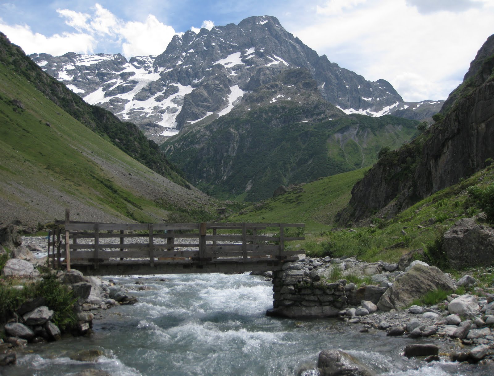
The Parc National des Écrins (Écrins National Park) is the largest and highest national park in France and the area it covers, one of the most challenging of alpine environments. The GR54 long distance footpath carves a circular route through and around these mountains and is considered to be one of the toughest multi-day treks in Europe. That said, no technical skills are required although some scrambling ability, sure-footedness and a reasonable head for heights all come in useful.

Le Sirac Dominates the Col de Vallonpierre

The GR54 runs to 110 miles in length, crosses 14 high passes and ascends almost 13,000m/42,000 ft. It is usually completed in 10-13 days. Our combined group of trekkers planned to undertake a 6-day circumnavigation of the most remote and challenging section of the route covering over 60 of those miles and crossing 9 of the high passes. This segment of the GR54 twists and turns around the flanks of high alpine peaks, climbs over high passes before plunging into deep, remote valleys far from most permanent settlements. The trail is generally clearly defined and well maintained although some exposed sections on the high passes require care.

Day 1

The trek began at the road-head west of the village of Vallouise, 20km SW of Briançon. We followed the path alongside a fast-flowing glacial stream through a pine-scented wooded valley in 30°stifling heat pausing frequently for rest and water!

The Climbing Begins!

Eventually the climbing begins, up over stony ground and some scree and then compacted shale (dodgy when wet) to the first of 2 cols: the Col de l’Aup Martin (2761m), the highest point on the GR54. Here the temperature was mercifully comfortable although we knew the heat would return on the descent. A short traverse over scree led to the Pas de la Cavale (2735m) en route to which, an unavoidable spray waterfall gave us all a refreshing shower!

Traversing Between the Cols

There then followed the first of several long weary descents steeply down to the grasslands of the Vallée de Champoléon and the first night’s accommodation at the Refuge du Pré de la Chaumette, a 62-bed mountain refuge at 1790m. This hut provided excellent facilities, good food and was constantly surrounded by marmots which provided a soundtrack of chirps and whistles to this welcome alpine fastness.

Day 2

Yesterday’s 2-col sweetener was trumped by today’s 3-col roller-coaster ride. An early start gave us shade and welcome coolness for the climb up the Vallon de la Pierre up switchbacks to the first high pass of the day: the Col de la Vallette (2668m). The path drops steeply from here, but not for long, before crossing a grassy valley to the Col de Gouiran (2597m).

Col de la Vallette

Some lingering snowfields and a charming lake provided some scenic interest and the traverse to the second col took only 45 mins. The descent from this col is more straightforward than the previous ones and crosses a series of eroded shaley ribs before climbing to the Col de Vallonpierre (2607m).

Col de la Vallette From Col de Gouiran

Much of today’s route circumnavigated the distinctive peak of Le Sirac (3441m) which looms above this last col. We resisted the good doctor’s exhortations to throw in an alpine ascent of a snow peak into our itinerary and enjoyed the spectacular views instead! We then descended steadily to the delightful, if crowded, Refuge de Vallonpierre standing on the edge of the glass-like Lac de Vallonpierre.

Le Sirac

After a break for lunch we continued down into the green wooded Vallée du Valgaudemar and our second night’s accommodation: the Refuge du Clot, a homely 50-bed hut surrounded by trees at 1400m. Another excellent meal, hut guardians Pierre and Caroline and some very friendly chickens (you had to be there) all combined to make a memorable evening. We even saw the only chamois of the trek – albeit a distant speck high on the valley wall!

Le Sirac From the Head of the Vallée du Valgaudemar

Day 3

Our third day began with an easy valley walk for 2 hrs before stopping for coffee and croissants at the only permanent settlement we came across, the small outdoor activity centre of La Chapelle-en-Valgaudemar. A further hour along the valley floor to Villar-Loubière and we could put it off no longer: the 4hr hot, steep and dusty 1500m slog up to the Col de la Vaurze (2498m). This was definitely the crux of the whole week! The only respite was a brief drinks stop at the well-placed Refuge des Souffles (1975m).

Col de la Vaurze - the Crux!

There followed an interesting traverse across the upper valley headwall before more interminable switchbacks brought us to the Col de la Vaurze. From here we looked directly down on our night’s destination, Le Désert-en-Valjouffrey (1255m) nestling in the valley below – but it would still take another 2hrs to reach the hamlet from the col.

The Descent to Le Désert

The Gîte le Désert provided basic accommodation but the highlight of the stop-over was definitely the €1.20 a shot whisky the good doctor and I imbibed ourselves with for much of the evening whilst trying to work out why you can’t see the dark side of the moon (you had to be there)! Most agreeable.

Le Désert-en-Valjouffrey

Day 4

Following 3 big days, the walking was about to become a little easier and the days shorter as we entered the western part of the Écrins National Park. The scenery also becomes a little softer and the cols a little less austere. From Le Désert, we climbed in early morning comfort and on a good path to the grassy Col de Côte Belle (2290m) before descending through stands of alpenrose and pine forest to the village of Valsenestre (1294m).

The View South From the Col de Côte Belle

Beautiful and idyllic in mid-summer, the hamlet’s summer residents desert the place for winter before snow and avalanches cut off the valley! The very comfortable 25-bed Gîte Le Beranger provided excellent rooms, facilities and food for our valiant band of trekkers. The afternoon off was most welcome!

Day 5

Having originally planned to cover the trek in 6 days, we decided to combine the last 2 relatively easy days into one last big day. Although tiring, this would give us a full day off at the end of the trek for some welcome respite and maybe even lunch in Briançon! We started by returning along the previous day’s route for half an hour before climbing up through grass, then rock, and finally a steep shale cone to the Col de la Muzelle (2625m).

Col de la Muzelle

Much of this was achieved in welcome shade and a cool breeze before the temperature started rising again as we descended over snowfields (nice nose-dive Toity!) down into a grassy valley to the Lac de la Muzelle and its attendant Refuge de la Muzelle.

Col de la Muzelle From the Muzelle Refuge and Lake

Just before reaching the refuge we turned left for the 90-min climb up switchbacks to the Col du Vallon (2531m) our last high pass of the week. Soaring eagles and distant views of snowy peaks entertained us as we plodded ever upwards. There followed a long and twisting descent to the blue-green waters of one of the highlights of the whole GR54, the picturesque Lac Lauvitel (1540m). We just had to stop here in this sublime setting - the girls went for a swim and the guys paddled and everyone sunbathed (like we really needed more sun)! From the lake, a short 30 min descent brought us to journey’s end and a waiting car at the village of La Danchére.

Lac Lauvitel

Overall, we covered 95km and climbed 7260m! This is definitely the most challenging – and rewarding – part of the GR54 and we were not disappointed. If you are planning to check it out, the GR54 is usually attempted between mid-July and late September when snow and ice are normally no longer a factor. However, some isolated patches of late Spring snow may be encountered and for that reason it is prudent to consider carrying an ice axe if travelling early in the season. Otherwise, you can expect very warm weather (hot in the valleys) with the occasional afternoon thunderstorm. Oh, and have plenty of Radox waiting at home for when you get back!

Approaching the Col de la Muzelle

Check out my future plans for similar walks on: http://www.hillways.co.uk/alpine/alpine.htm